You are here: Home > Network List > TA - USArray Transportable Network (new EarthScope stations) Stations List
> Station Q61A Milford, DE, USA > Earthquake Result Viewer
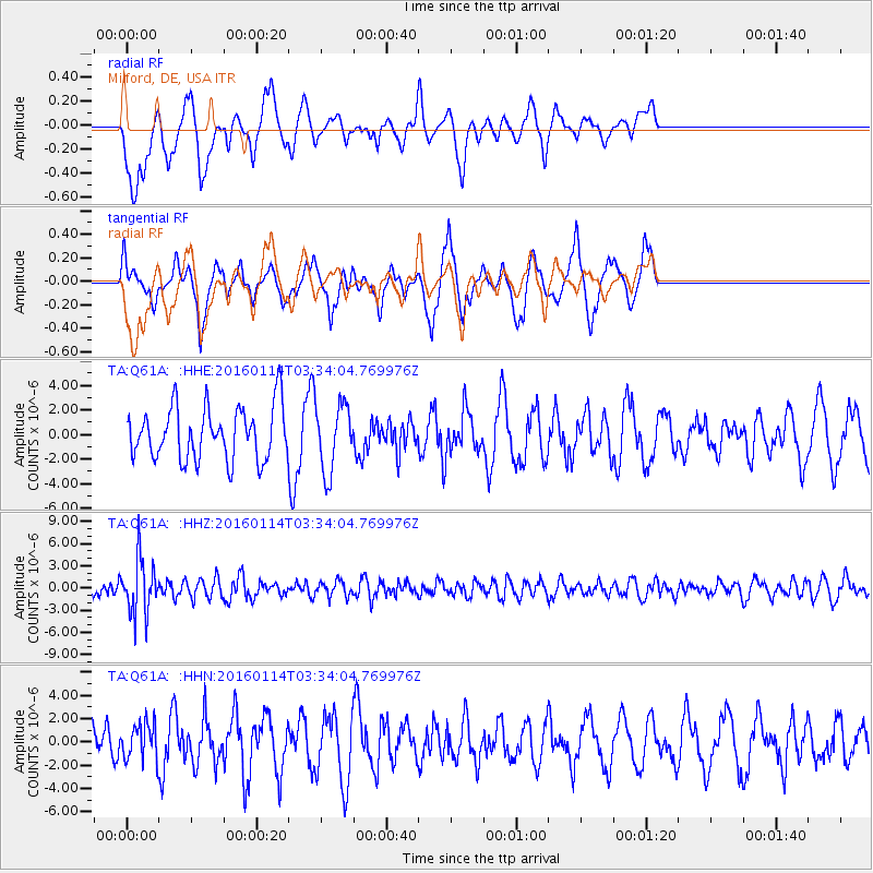
Q61A Milford, DE, USA - Earthquake Result Viewer
*The percent match for this event was below the threshold and hence no stack was calculated.
| Earthquake location: |
Southern Bolivia |
| Earthquake latitude/longitude: |
-19.8/-63.3 |
| Earthquake time(UTC): |
2016/01/14 (014) 03:25:28 GMT |
| Earthquake Depth: |
582 km |
| Earthquake Magnitude: |
6.1 MWW, 6.1 MWB |
| Earthquake Catalog/Contributor: |
NEIC PDE/NEIC COMCAT |
|
| Network: |
TA USArray Transportable Network (new EarthScope stations) |
| Station: |
Q61A Milford, DE, USA |
| Lat/Lon: |
38.88 N/75.33 W |
| Elevation: |
5.0 m |
|
| Distance: |
59.5 deg |
| Az: |
349.105 deg |
| Baz: |
166.822 deg |
| Ray Param: |
$rayparam |
*The percent match for this event was below the threshold and hence was not used in the summary stack. |
|
| Radial Match: |
41.829548 % |
| Radial Bump: |
384 |
| Transverse Match: |
42.220093 % |
| Transverse Bump: |
299 |
| SOD ConfigId: |
7422571 |
| Insert Time: |
2019-04-21 18:06:54.626 +0000 |
| GWidth: |
2.5 |
| Max Bumps: |
400 |
| Tol: |
0.001 |
|
Signal To Noise
| Channel | StoN | STA | LTA |
| TA:Q61A: :HHZ:20160114T03:34:04.769976Z | 3.6933084 | 3.7055536E-6 | 1.0033154E-6 |
| TA:Q61A: :HHN:20160114T03:34:04.769976Z | 0.73397475 | 1.5985544E-6 | 2.177942E-6 |
| TA:Q61A: :HHE:20160114T03:34:04.769976Z | 1.1893475 | 2.624619E-6 | 2.206772E-6 |
| Arrivals |
| Ps | |
| PpPs | |
| PsPs/PpSs | |


