You are here: Home > Network List > TA - USArray Transportable Network (new EarthScope stations) Stations List
> Station Q61A Milford, DE, USA > Earthquake Result Viewer
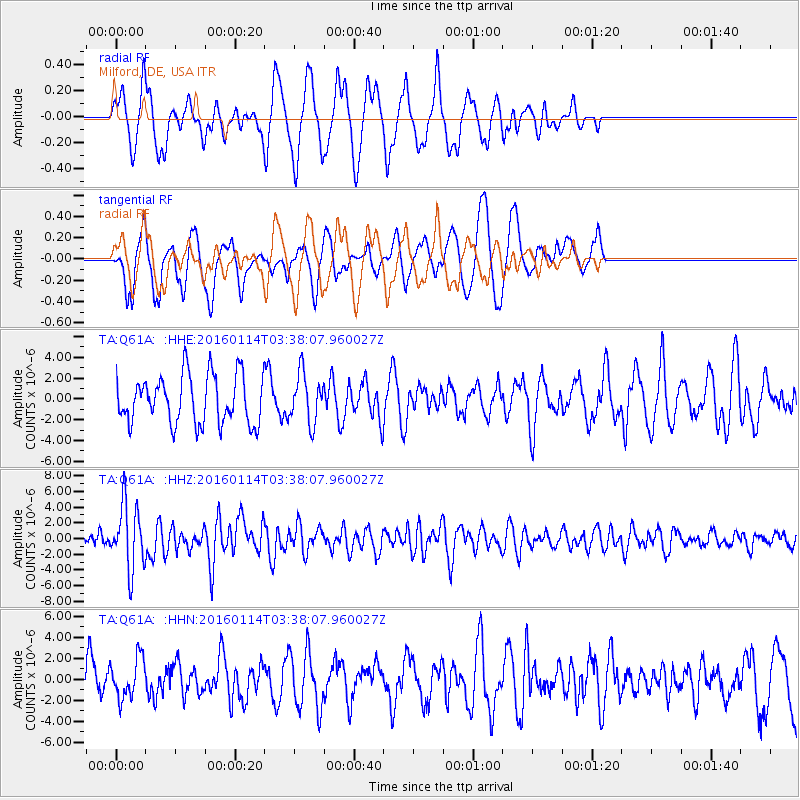
Q61A Milford, DE, USA - Earthquake Result Viewer
*The percent match for this event was below the threshold and hence no stack was calculated.
| Earthquake location: |
Hokkaido, Japan Region |
| Earthquake latitude/longitude: |
42.0/142.7 |
| Earthquake time(UTC): |
2016/01/14 (014) 03:25:34 GMT |
| Earthquake Depth: |
51 km |
| Earthquake Magnitude: |
6.7 MWP, 6.7 MI |
| Earthquake Catalog/Contributor: |
NEIC PDE/NEIC COMCAT |
|
| Network: |
TA USArray Transportable Network (new EarthScope stations) |
| Station: |
Q61A Milford, DE, USA |
| Lat/Lon: |
38.88 N/75.33 W |
| Elevation: |
5.0 m |
|
| Distance: |
92.4 deg |
| Az: |
28.781 deg |
| Baz: |
332.605 deg |
| Ray Param: |
$rayparam |
*The percent match for this event was below the threshold and hence was not used in the summary stack. |
|
| Radial Match: |
59.44118 % |
| Radial Bump: |
400 |
| Transverse Match: |
51.93128 % |
| Transverse Bump: |
400 |
| SOD ConfigId: |
7422571 |
| Insert Time: |
2019-04-21 18:23:14.393 +0000 |
| GWidth: |
2.5 |
| Max Bumps: |
400 |
| Tol: |
0.001 |
|
Signal To Noise
| Channel | StoN | STA | LTA |
| TA:Q61A: :HHZ:20160114T03:38:07.960027Z | 3.398702 | 4.1285066E-6 | 1.2147303E-6 |
| TA:Q61A: :HHN:20160114T03:38:07.960027Z | 0.83286947 | 1.9091208E-6 | 2.2922209E-6 |
| TA:Q61A: :HHE:20160114T03:38:07.960027Z | 0.9942099 | 2.3271978E-6 | 2.340751E-6 |
| Arrivals |
| Ps | |
| PpPs | |
| PsPs/PpSs | |


