You are here: Home > Network List > US - United States National Seismic Network Stations List
> Station RSSD Black Hills, South Dakota, USA > Earthquake Result Viewer
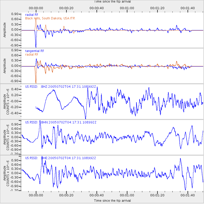
RSSD Black Hills, South Dakota, USA - Earthquake Result Viewer
*The percent match for this event was below the threshold and hence no stack was calculated.
| Earthquake location: |
Near Coast Of Nicaragua |
| Earthquake latitude/longitude: |
11.4/-86.3 |
| Earthquake time(UTC): |
2005/07/02 (183) 04:11:04 GMT |
| Earthquake Depth: |
40 km |
| Earthquake Magnitude: |
5.4 MB, 5.4 MS, 5.8 MW, 5.0 MD |
| Earthquake Catalog/Contributor: |
WHDF/NEIC |
|
| Network: |
US United States National Seismic Network |
| Station: |
RSSD Black Hills, South Dakota, USA |
| Lat/Lon: |
44.12 N/104.04 W |
| Elevation: |
2060 m |
|
| Distance: |
36.0 deg |
| Az: |
338.037 deg |
| Baz: |
149.391 deg |
| Ray Param: |
$rayparam |
*The percent match for this event was below the threshold and hence was not used in the summary stack. |
|
| Radial Match: |
76.81734 % |
| Radial Bump: |
400 |
| Transverse Match: |
49.23795 % |
| Transverse Bump: |
334 |
| SOD ConfigId: |
3128 |
| Insert Time: |
2010-03-05 06:32:57.837 +0000 |
| GWidth: |
2.5 |
| Max Bumps: |
400 |
| Tol: |
0.001 |
|
Signal To Noise
| Channel | StoN | STA | LTA |
| US:RSSD: :BHN:20050702T04:17:31.108992Z | 3.256653 | 5.2585034E-7 | 1.6146956E-7 |
| US:RSSD: :BHE:20050702T04:17:31.108992Z | 2.82912 | 4.866813E-7 | 1.720257E-7 |
| US:RSSD: :BHZ:20050702T04:17:31.108992Z | 1.2261865 | 2.6848338E-7 | 2.1895802E-7 |
| Arrivals |
| Ps | |
| PpPs | |
| PsPs/PpSs | |


