
UGM GEOFON Station Wanagama, Indonesia - Earthquake Result Viewer
| ||||||||||||||||||
| ||||||||||||||||||
| ||||||||||||||||||
|
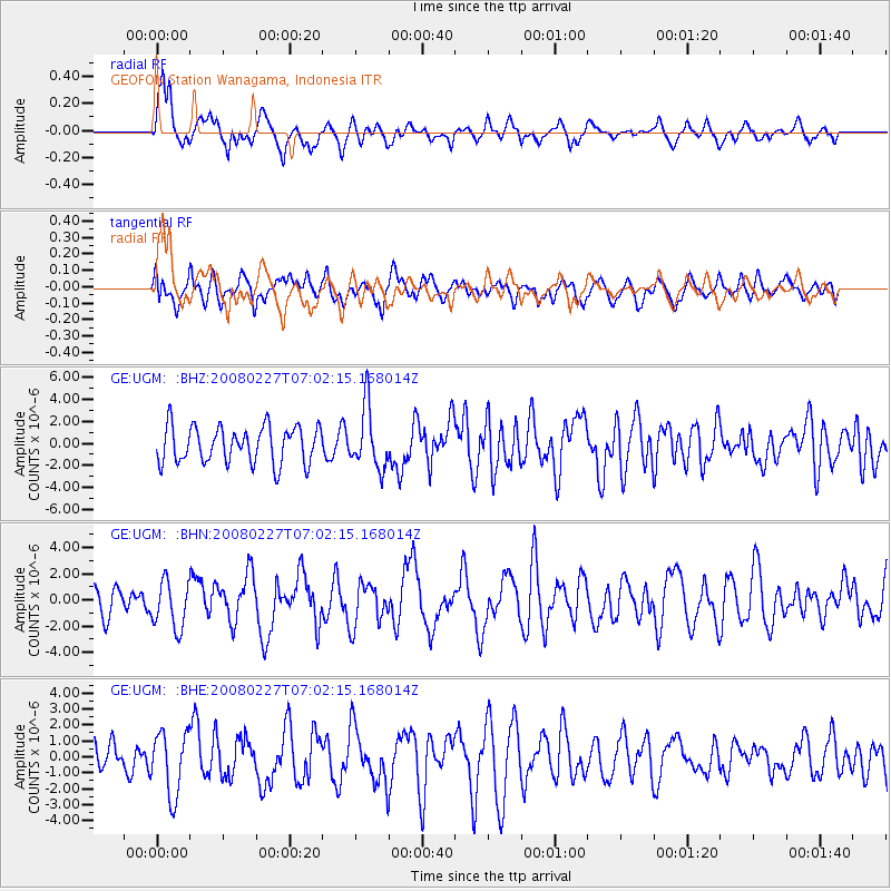
Signal To Noise
| Channel | StoN | STA | LTA |
| GE:UGM: :BHN:20080227T07:02:15.168014Z | 1.6577966 | 1.7979804E-6 | 1.0845603E-6 |
| GE:UGM: :BHE:20080227T07:02:15.168014Z | 2.1899874 | 1.982229E-6 | 9.051325E-7 |
| GE:UGM: :BHZ:20080227T07:02:15.168014Z | 1.6585507 | 2.765941E-6 | 1.6676855E-6 |
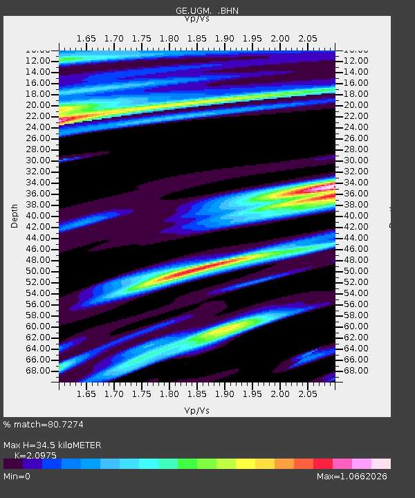
| Arrivals | |
| Ps | 6.3 SECOND |
| PpPs | 16 SECOND |
| PsPs/PpSs | 22 SECOND |

