
UGM GEOFON Station Wanagama, Indonesia - Earthquake Result Viewer
| ||||||||||||||||||
| ||||||||||||||||||
| ||||||||||||||||||
|
Signal To Noise
| Channel | StoN | STA | LTA |
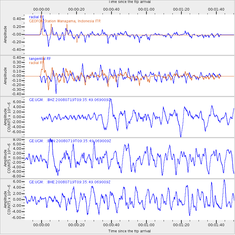
| GE:UGM: :BHN:20080719T09:35:49.069009Z | 2.961284 | 2.5225336E-6 | 8.518378E-7 |
| GE:UGM: :BHE:20080719T09:35:49.069009Z | 1.1475538 | 9.320705E-7 | 8.1222385E-7 |
| GE:UGM: :BHZ:20080719T09:35:49.069009Z | 1.6000526 | 9.983326E-7 | 6.2393735E-7 |
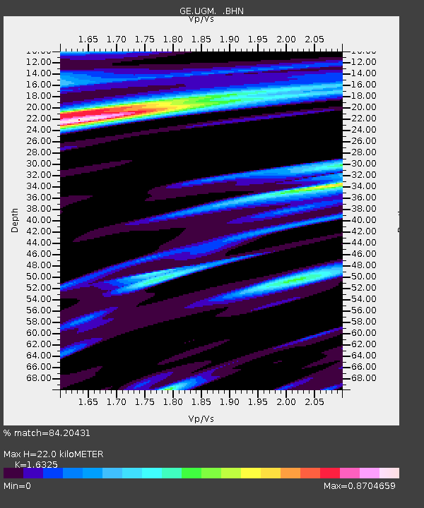
| Arrivals | |
| Ps | 2.3 SECOND |
| PpPs | 8.6 SECOND |
| PsPs/PpSs | 11 SECOND |

