You are here: Home > Network List > GE - GEOFON Stations List
> Station UGM GEOFON Station Wanagama, Indonesia > Earthquake Result Viewer
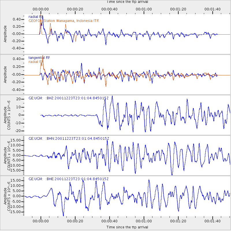
UGM GEOFON Station Wanagama, Indonesia - Earthquake Result Viewer
*The percent match for this event was below the threshold and hence no stack was calculated.
| Earthquake location: |
Solomon Islands |
| Earthquake latitude/longitude: |
-9.6/159.5 |
| Earthquake time(UTC): |
2001/12/23 (357) 22:52:54 GMT |
| Earthquake Depth: |
16 km |
| Earthquake Magnitude: |
6.2 MB, 7.0 MS, 6.8 MW, 6.7 MW |
| Earthquake Catalog/Contributor: |
WHDF/NEIC |
|
| Network: |
GE GEOFON |
| Station: |
UGM GEOFON Station Wanagama, Indonesia |
| Lat/Lon: |
7.91 S/110.52 E |
| Elevation: |
350 m |
|
| Distance: |
48.4 deg |
| Az: |
267.928 deg |
| Baz: |
95.821 deg |
| Ray Param: |
$rayparam |
*The percent match for this event was below the threshold and hence was not used in the summary stack. |
|
| Radial Match: |
84.232 % |
| Radial Bump: |
400 |
| Transverse Match: |
73.65961 % |
| Transverse Bump: |
400 |
| SOD ConfigId: |
20082 |
| Insert Time: |
2010-03-09 05:09:59.965 +0000 |
| GWidth: |
2.5 |
| Max Bumps: |
400 |
| Tol: |
0.001 |
|
Signal To Noise
| Channel | StoN | STA | LTA |
| GE:UGM: :BHN:20011223T23:01:04.845015Z | 1.5982211 | 7.4240563E-7 | 4.6451999E-7 |
| GE:UGM: :BHE:20011223T23:01:04.845015Z | 2.8195314 | 1.5091308E-6 | 5.352417E-7 |
| GE:UGM: :BHZ:20011223T23:01:04.845015Z | 7.7190385 | 4.2325055E-6 | 5.4832026E-7 |
| Arrivals |
| Ps | |
| PpPs | |
| PsPs/PpSs | |


