
UGM GEOFON Station Wanagama, Indonesia - Earthquake Result Viewer
| ||||||||||||||||||
| ||||||||||||||||||
| ||||||||||||||||||
|
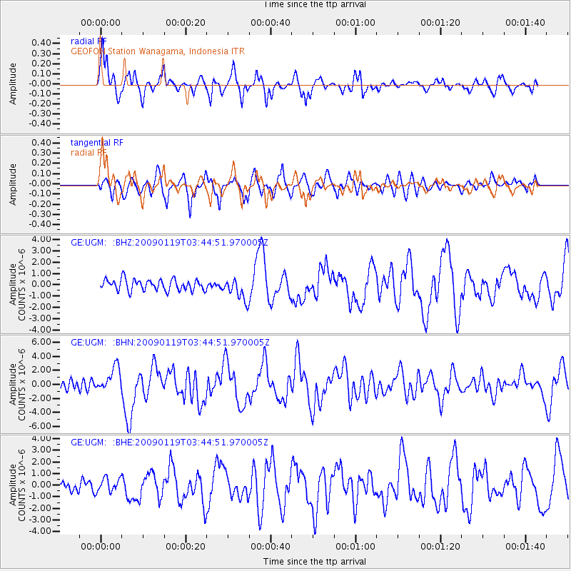
Signal To Noise
| Channel | StoN | STA | LTA |
| GE:UGM: :BHN:20090119T03:44:51.970005Z | 4.046801 | 1.8131534E-6 | 4.4804608E-7 |
| GE:UGM: :BHE:20090119T03:44:51.970005Z | 1.8507713 | 5.787305E-7 | 3.1269693E-7 |
| GE:UGM: :BHZ:20090119T03:44:51.970005Z | 2.078428 | 1.0173969E-6 | 4.895031E-7 |
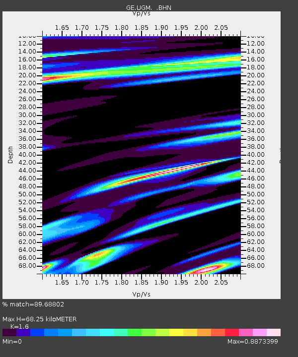
| Arrivals | |
| Ps | 6.8 SECOND |
| PpPs | 27 SECOND |
| PsPs/PpSs | 33 SECOND |

