
UGM GEOFON Station Wanagama, Indonesia - Earthquake Result Viewer
| ||||||||||||||||||
| ||||||||||||||||||
| ||||||||||||||||||
|
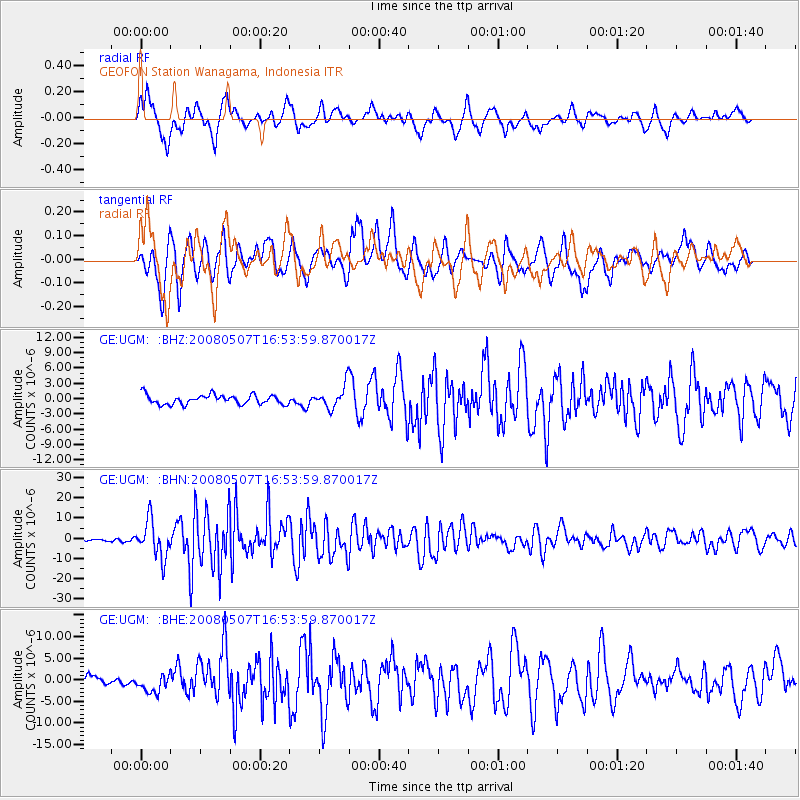
Signal To Noise
| Channel | StoN | STA | LTA |
| GE:UGM: :BHN:20080507T16:53:59.870017Z | 11.320249 | 9.0436015E-6 | 7.9888713E-7 |
| GE:UGM: :BHE:20080507T16:53:59.870017Z | 2.071792 | 2.1460298E-6 | 1.0358327E-6 |
| GE:UGM: :BHZ:20080507T16:53:59.870017Z | 2.351825 | 2.202102E-6 | 9.363376E-7 |
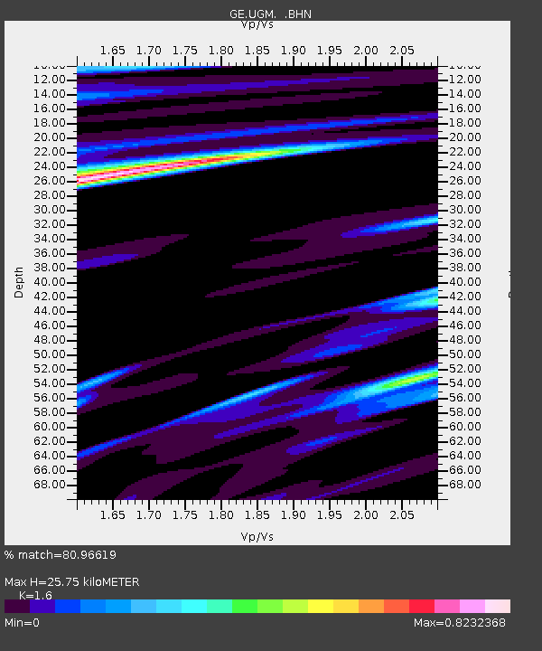
| Arrivals | |
| Ps | 2.6 SECOND |
| PpPs | 9.9 SECOND |
| PsPs/PpSs | 13 SECOND |

