You are here: Home > Network List > GE - GEOFON Stations List
> Station UGM GEOFON Station Wanagama, Indonesia > Earthquake Result Viewer
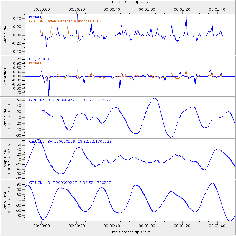
UGM GEOFON Station Wanagama, Indonesia - Earthquake Result Viewer
*The percent match for this event was below the threshold and hence no stack was calculated.
| Earthquake location: |
Samoa Islands Region |
| Earthquake latitude/longitude: |
-16.2/-173.0 |
| Earthquake time(UTC): |
2009/09/29 (272) 18:21:42 GMT |
| Earthquake Depth: |
10 km |
| Earthquake Magnitude: |
5.8 MB |
| Earthquake Catalog/Contributor: |
WHDF/NEIC |
|
| Network: |
GE GEOFON |
| Station: |
UGM GEOFON Station Wanagama, Indonesia |
| Lat/Lon: |
7.91 S/110.52 E |
| Elevation: |
350 m |
|
| Distance: |
74.9 deg |
| Az: |
266.006 deg |
| Baz: |
104.643 deg |
| Ray Param: |
$rayparam |
*The percent match for this event was below the threshold and hence was not used in the summary stack. |
|
| Radial Match: |
52.296288 % |
| Radial Bump: |
360 |
| Transverse Match: |
89.583496 % |
| Transverse Bump: |
218 |
| SOD ConfigId: |
2622 |
| Insert Time: |
2010-03-09 05:10:54.452 +0000 |
| GWidth: |
2.5 |
| Max Bumps: |
400 |
| Tol: |
0.001 |
|
Signal To Noise
| Channel | StoN | STA | LTA |
| GE:UGM: :BHN:20090929T18:32:52.170022Z | 1.4878471 | 5.1780233E-5 | 3.480212E-5 |
| GE:UGM: :BHE:20090929T18:32:52.170022Z | 2.0743377 | 1.0639091E-4 | 5.1289095E-5 |
| GE:UGM: :BHZ:20090929T18:32:52.170022Z | 0.49252656 | 9.539532E-6 | 1.9368563E-5 |
| Arrivals |
| Ps | |
| PpPs | |
| PsPs/PpSs | |


