You are here: Home > Network List > GE - GEOFON Stations List
> Station UGM GEOFON Station Wanagama, Indonesia > Earthquake Result Viewer
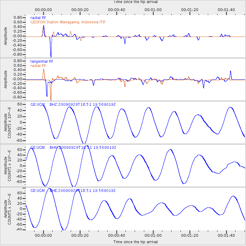
UGM GEOFON Station Wanagama, Indonesia - Earthquake Result Viewer
*The percent match for this event was below the threshold and hence no stack was calculated.
| Earthquake location: |
Tonga Islands |
| Earthquake latitude/longitude: |
-15.4/-173.2 |
| Earthquake time(UTC): |
2009/09/29 (272) 18:40:09 GMT |
| Earthquake Depth: |
2.3 km |
| Earthquake Magnitude: |
5.5 MB |
| Earthquake Catalog/Contributor: |
WHDF/NEIC |
|
| Network: |
GE GEOFON |
| Station: |
UGM GEOFON Station Wanagama, Indonesia |
| Lat/Lon: |
7.91 S/110.52 E |
| Elevation: |
350 m |
|
| Distance: |
74.7 deg |
| Az: |
265.844 deg |
| Baz: |
103.753 deg |
| Ray Param: |
$rayparam |
*The percent match for this event was below the threshold and hence was not used in the summary stack. |
|
| Radial Match: |
90.8365 % |
| Radial Bump: |
366 |
| Transverse Match: |
69.126755 % |
| Transverse Bump: |
398 |
| SOD ConfigId: |
2622 |
| Insert Time: |
2010-03-09 05:10:55.672 +0000 |
| GWidth: |
2.5 |
| Max Bumps: |
400 |
| Tol: |
0.001 |
|
Signal To Noise
| Channel | StoN | STA | LTA |
| GE:UGM: :BHN:20090929T18:51:19.569019Z | 1.3562677 | 5.986601E-5 | 4.4140263E-5 |
| GE:UGM: :BHE:20090929T18:51:19.569019Z | 2.1619873 | 5.9427417E-5 | 2.7487402E-5 |
| GE:UGM: :BHZ:20090929T18:51:19.569019Z | 0.92920846 | 3.814931E-5 | 4.1055704E-5 |
| Arrivals |
| Ps | |
| PpPs | |
| PsPs/PpSs | |


