You are here: Home > Network List > GE - GEOFON Stations List
> Station UGM GEOFON Station Wanagama, Indonesia > Earthquake Result Viewer
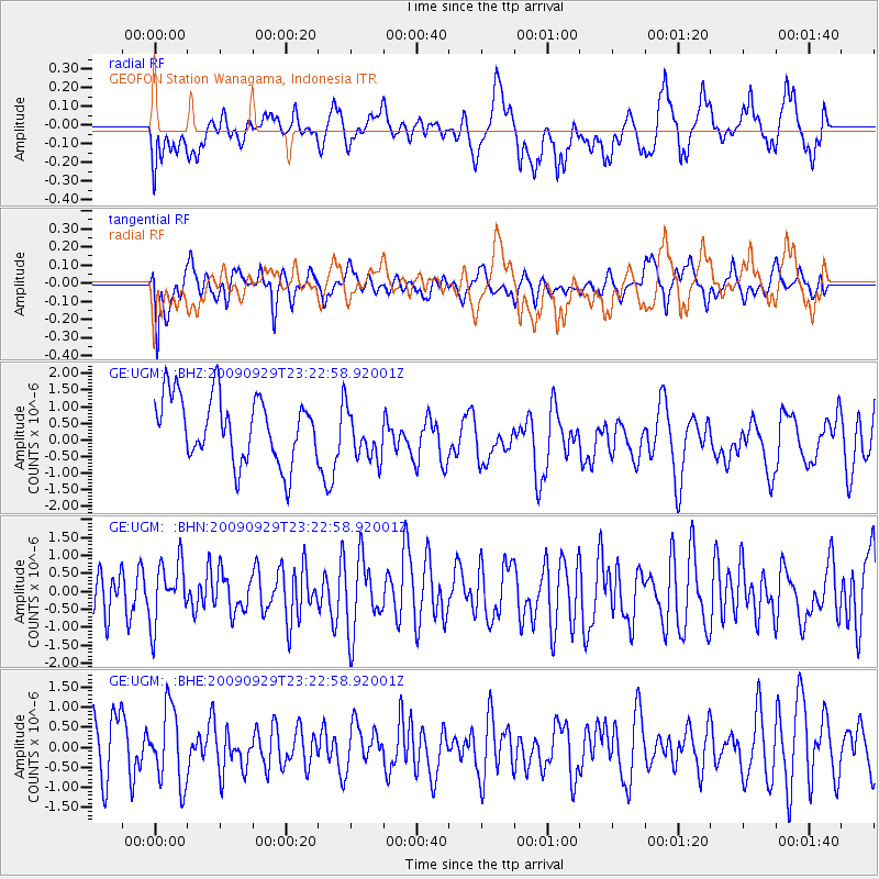
UGM GEOFON Station Wanagama, Indonesia - Earthquake Result Viewer
*The percent match for this event was below the threshold and hence no stack was calculated.
| Earthquake location: |
Tonga Islands |
| Earthquake latitude/longitude: |
-15.6/-173.4 |
| Earthquake time(UTC): |
2009/09/29 (272) 23:11:51 GMT |
| Earthquake Depth: |
10 km |
| Earthquake Magnitude: |
5.5 MB |
| Earthquake Catalog/Contributor: |
WHDF/NEIC |
|
| Network: |
GE GEOFON |
| Station: |
UGM GEOFON Station Wanagama, Indonesia |
| Lat/Lon: |
7.91 S/110.52 E |
| Elevation: |
350 m |
|
| Distance: |
74.6 deg |
| Az: |
265.944 deg |
| Baz: |
103.998 deg |
| Ray Param: |
$rayparam |
*The percent match for this event was below the threshold and hence was not used in the summary stack. |
|
| Radial Match: |
59.94289 % |
| Radial Bump: |
400 |
| Transverse Match: |
50.202682 % |
| Transverse Bump: |
400 |
| SOD ConfigId: |
2622 |
| Insert Time: |
2010-03-09 05:10:56.655 +0000 |
| GWidth: |
2.5 |
| Max Bumps: |
400 |
| Tol: |
0.001 |
|
Signal To Noise
| Channel | StoN | STA | LTA |
| GE:UGM: :BHN:20090929T23:22:58.92001Z | 1.042799 | 8.4383527E-7 | 8.092023E-7 |
| GE:UGM: :BHE:20090929T23:22:58.92001Z | 1.0612215 | 9.3930635E-7 | 8.85118E-7 |
| GE:UGM: :BHZ:20090929T23:22:58.92001Z | 0.8059219 | 7.874397E-7 | 9.77067E-7 |
| Arrivals |
| Ps | |
| PpPs | |
| PsPs/PpSs | |


