You are here: Home > Network List > GE - GEOFON Stations List
> Station UGM GEOFON Station Wanagama, Indonesia > Earthquake Result Viewer
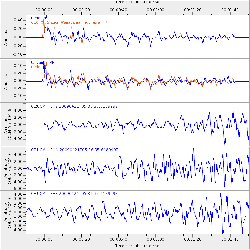
UGM GEOFON Station Wanagama, Indonesia - Earthquake Result Viewer
*The percent match for this event was below the threshold and hence no stack was calculated.
| Earthquake location: |
Kuril Islands |
| Earthquake latitude/longitude: |
50.8/155.0 |
| Earthquake time(UTC): |
2009/04/21 (111) 05:26:11 GMT |
| Earthquake Depth: |
152 km |
| Earthquake Magnitude: |
6.0 MB, 6.2 MW, 6.2 MW |
| Earthquake Catalog/Contributor: |
WHDF/NEIC |
|
| Network: |
GE GEOFON |
| Station: |
UGM GEOFON Station Wanagama, Indonesia |
| Lat/Lon: |
7.91 S/110.52 E |
| Elevation: |
350 m |
|
| Distance: |
70.0 deg |
| Az: |
227.63 deg |
| Baz: |
28.226 deg |
| Ray Param: |
$rayparam |
*The percent match for this event was below the threshold and hence was not used in the summary stack. |
|
| Radial Match: |
65.95947 % |
| Radial Bump: |
387 |
| Transverse Match: |
53.863342 % |
| Transverse Bump: |
400 |
| SOD ConfigId: |
2658 |
| Insert Time: |
2010-03-09 05:11:18.435 +0000 |
| GWidth: |
2.5 |
| Max Bumps: |
400 |
| Tol: |
0.001 |
|
Signal To Noise
| Channel | StoN | STA | LTA |
| GE:UGM: :BHN:20090421T05:36:35.618999Z | 4.519998 | 1.7870577E-6 | 3.9536692E-7 |
| GE:UGM: :BHE:20090421T05:36:35.618999Z | 1.1473007 | 7.331463E-7 | 6.390184E-7 |
| GE:UGM: :BHZ:20090421T05:36:35.618999Z | 0.8898884 | 6.1472895E-7 | 6.907933E-7 |
| Arrivals |
| Ps | |
| PpPs | |
| PsPs/PpSs | |


