You are here: Home > Network List > GE - GEOFON Stations List
> Station UGM GEOFON Station Wanagama, Indonesia > Earthquake Result Viewer
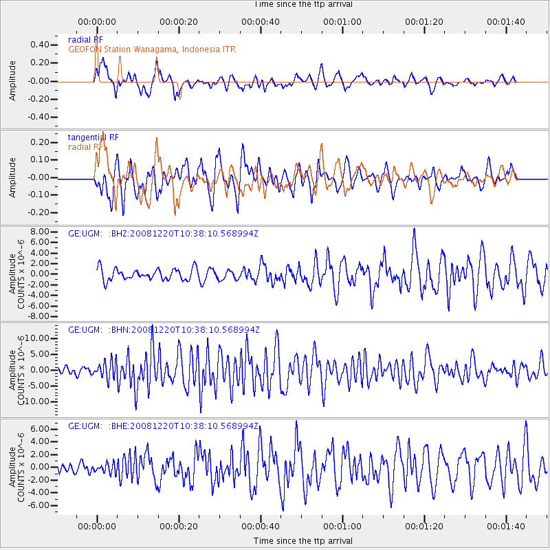
UGM GEOFON Station Wanagama, Indonesia - Earthquake Result Viewer
*The percent match for this event was below the threshold and hence no stack was calculated.
| Earthquake location: |
Off East Coast Of Honshu, Japan |
| Earthquake latitude/longitude: |
36.5/142.4 |
| Earthquake time(UTC): |
2008/12/20 (355) 10:29:23 GMT |
| Earthquake Depth: |
19 km |
| Earthquake Magnitude: |
6.0 MB, 6.3 MS, 6.3 MW, 6.3 MW |
| Earthquake Catalog/Contributor: |
WHDF/NEIC |
|
| Network: |
GE GEOFON |
| Station: |
UGM GEOFON Station Wanagama, Indonesia |
| Lat/Lon: |
7.91 S/110.52 E |
| Elevation: |
350 m |
|
| Distance: |
53.4 deg |
| Az: |
220.698 deg |
| Baz: |
32.013 deg |
| Ray Param: |
$rayparam |
*The percent match for this event was below the threshold and hence was not used in the summary stack. |
|
| Radial Match: |
76.85019 % |
| Radial Bump: |
400 |
| Transverse Match: |
79.14542 % |
| Transverse Bump: |
400 |
| SOD ConfigId: |
2658 |
| Insert Time: |
2010-03-09 05:11:20.396 +0000 |
| GWidth: |
2.5 |
| Max Bumps: |
400 |
| Tol: |
0.001 |
|
Signal To Noise
| Channel | StoN | STA | LTA |
| GE:UGM: :BHN:20081220T10:38:10.568994Z | 2.581881 | 2.6800024E-6 | 1.0380038E-6 |
| GE:UGM: :BHE:20081220T10:38:10.568994Z | 0.7018901 | 6.897239E-7 | 9.826665E-7 |
| GE:UGM: :BHZ:20081220T10:38:10.568994Z | 0.7962581 | 8.473633E-7 | 1.0641818E-6 |
| Arrivals |
| Ps | |
| PpPs | |
| PsPs/PpSs | |


