You are here: Home > Network List > GE - GEOFON Stations List
> Station UGM GEOFON Station Wanagama, Indonesia > Earthquake Result Viewer
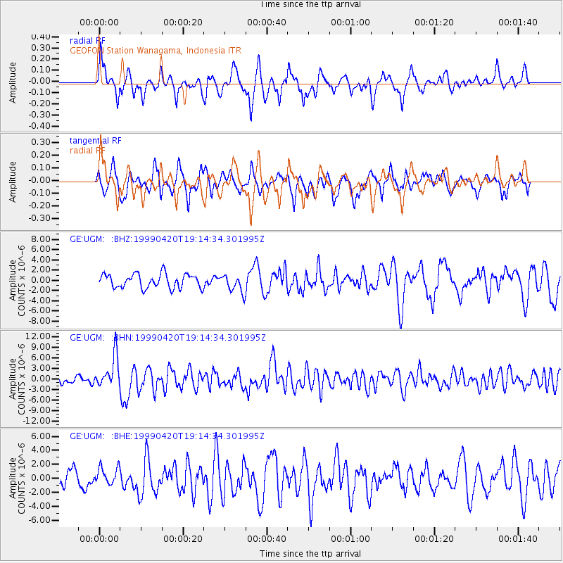
UGM GEOFON Station Wanagama, Indonesia - Earthquake Result Viewer
*The percent match for this event was below the threshold and hence no stack was calculated.
| Earthquake location: |
Kermadec Islands Region |
| Earthquake latitude/longitude: |
-31.9/-179.0 |
| Earthquake time(UTC): |
1999/04/20 (110) 19:04:08 GMT |
| Earthquake Depth: |
96 km |
| Earthquake Magnitude: |
6.2 MB, 6.5 MW, 6.5 MW |
| Earthquake Catalog/Contributor: |
WHDF/NEIC |
|
| Network: |
GE GEOFON |
| Station: |
UGM GEOFON Station Wanagama, Indonesia |
| Lat/Lon: |
7.91 S/110.52 E |
| Elevation: |
350 m |
|
| Distance: |
69.3 deg |
| Az: |
273.558 deg |
| Baz: |
121.01 deg |
| Ray Param: |
$rayparam |
*The percent match for this event was below the threshold and hence was not used in the summary stack. |
|
| Radial Match: |
76.12466 % |
| Radial Bump: |
400 |
| Transverse Match: |
67.676636 % |
| Transverse Bump: |
400 |
| SOD ConfigId: |
4480 |
| Insert Time: |
2010-03-09 05:11:32.170 +0000 |
| GWidth: |
2.5 |
| Max Bumps: |
400 |
| Tol: |
0.001 |
|
Signal To Noise
| Channel | StoN | STA | LTA |
| GE:UGM: :BHN:19990420T19:14:34.301995Z | 4.093641 | 4.6866185E-6 | 1.1448534E-6 |
| GE:UGM: :BHE:19990420T19:14:34.301995Z | 0.87907517 | 1.2807978E-6 | 1.4569833E-6 |
| GE:UGM: :BHZ:19990420T19:14:34.301995Z | 1.3004276 | 1.7670851E-6 | 1.3588493E-6 |
| Arrivals |
| Ps | |
| PpPs | |
| PsPs/PpSs | |


