You are here: Home > Network List > GE - GEOFON Stations List
> Station UGM GEOFON Station Wanagama, Indonesia > Earthquake Result Viewer
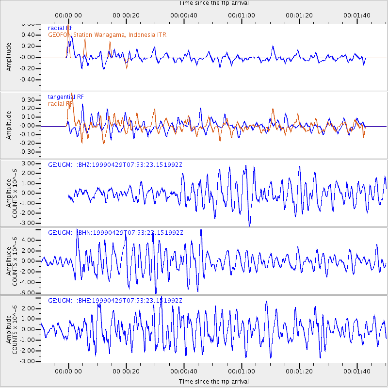
UGM GEOFON Station Wanagama, Indonesia - Earthquake Result Viewer
*The percent match for this event was below the threshold and hence no stack was calculated.
| Earthquake location: |
Southeast Of Ryukyu Islands |
| Earthquake latitude/longitude: |
28.9/131.1 |
| Earthquake time(UTC): |
1999/04/29 (119) 07:46:08 GMT |
| Earthquake Depth: |
33 km |
| Earthquake Magnitude: |
5.8 MB, 5.5 MS, 5.9 MW, 5.9 MW |
| Earthquake Catalog/Contributor: |
WHDF/NEIC |
|
| Network: |
GE GEOFON |
| Station: |
UGM GEOFON Station Wanagama, Indonesia |
| Lat/Lon: |
7.91 S/110.52 E |
| Elevation: |
350 m |
|
| Distance: |
41.6 deg |
| Az: |
211.688 deg |
| Baz: |
27.718 deg |
| Ray Param: |
$rayparam |
*The percent match for this event was below the threshold and hence was not used in the summary stack. |
|
| Radial Match: |
75.79394 % |
| Radial Bump: |
400 |
| Transverse Match: |
71.60083 % |
| Transverse Bump: |
400 |
| SOD ConfigId: |
4480 |
| Insert Time: |
2010-03-09 05:11:33.457 +0000 |
| GWidth: |
2.5 |
| Max Bumps: |
400 |
| Tol: |
0.001 |
|
Signal To Noise
| Channel | StoN | STA | LTA |
| GE:UGM: :BHN:19990429T07:53:23.151992Z | 3.8394027 | 2.3396317E-6 | 6.093739E-7 |
| GE:UGM: :BHE:19990429T07:53:23.151992Z | 1.1513435 | 5.374241E-7 | 4.6678E-7 |
| GE:UGM: :BHZ:19990429T07:53:23.151992Z | 1.0987921 | 4.5388833E-7 | 4.130794E-7 |
| Arrivals |
| Ps | |
| PpPs | |
| PsPs/PpSs | |


