You are here: Home > Network List > GE - GEOFON Stations List
> Station UGM GEOFON Station Wanagama, Indonesia > Earthquake Result Viewer
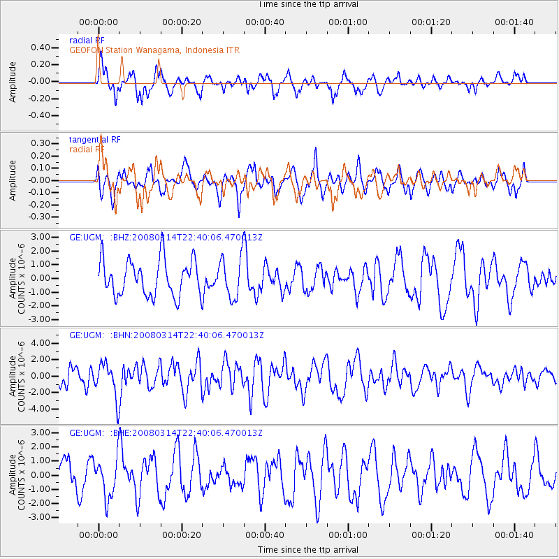
UGM GEOFON Station Wanagama, Indonesia - Earthquake Result Viewer
*The percent match for this event was below the threshold and hence no stack was calculated.
| Earthquake location: |
Bonin Islands, Japan Region |
| Earthquake latitude/longitude: |
27.0/142.6 |
| Earthquake time(UTC): |
2008/03/14 (074) 22:32:09 GMT |
| Earthquake Depth: |
11 km |
| Earthquake Magnitude: |
5.7 MB, 5.9 MS, 6.0 MW, 6.0 MW |
| Earthquake Catalog/Contributor: |
WHDF/NEIC |
|
| Network: |
GE GEOFON |
| Station: |
UGM GEOFON Station Wanagama, Indonesia |
| Lat/Lon: |
7.91 S/110.52 E |
| Elevation: |
350 m |
|
| Distance: |
46.6 deg |
| Az: |
226.402 deg |
| Baz: |
40.719 deg |
| Ray Param: |
$rayparam |
*The percent match for this event was below the threshold and hence was not used in the summary stack. |
|
| Radial Match: |
71.5544 % |
| Radial Bump: |
348 |
| Transverse Match: |
58.867313 % |
| Transverse Bump: |
400 |
| SOD ConfigId: |
2504 |
| Insert Time: |
2010-03-09 05:12:03.406 +0000 |
| GWidth: |
2.5 |
| Max Bumps: |
400 |
| Tol: |
0.001 |
|
Signal To Noise
| Channel | StoN | STA | LTA |
| GE:UGM: :BHN:20080314T22:40:06.470013Z | 2.4824262 | 2.1828766E-6 | 8.79332E-7 |
| GE:UGM: :BHE:20080314T22:40:06.470013Z | 1.4236646 | 1.4699685E-6 | 1.0325246E-6 |
| GE:UGM: :BHZ:20080314T22:40:06.470013Z | 1.1928711 | 1.562892E-6 | 1.3101935E-6 |
| Arrivals |
| Ps | |
| PpPs | |
| PsPs/PpSs | |


