You are here: Home > Network List > GE - GEOFON Stations List
> Station UGM GEOFON Station Wanagama, Indonesia > Earthquake Result Viewer
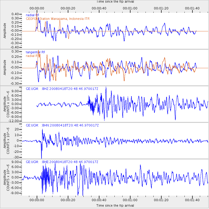
UGM GEOFON Station Wanagama, Indonesia - Earthquake Result Viewer
*The percent match for this event was below the threshold and hence no stack was calculated.
| Earthquake location: |
Fiji Islands Region |
| Earthquake latitude/longitude: |
-17.3/-179.0 |
| Earthquake time(UTC): |
2008/04/18 (109) 20:39:07 GMT |
| Earthquake Depth: |
554 km |
| Earthquake Magnitude: |
5.9 MB, 6.3 MW, 6.3 MW |
| Earthquake Catalog/Contributor: |
WHDF/NEIC |
|
| Network: |
GE GEOFON |
| Station: |
UGM GEOFON Station Wanagama, Indonesia |
| Lat/Lon: |
7.91 S/110.52 E |
| Elevation: |
350 m |
|
| Distance: |
69.1 deg |
| Az: |
268.01 deg |
| Baz: |
105.51 deg |
| Ray Param: |
$rayparam |
*The percent match for this event was below the threshold and hence was not used in the summary stack. |
|
| Radial Match: |
73.00174 % |
| Radial Bump: |
400 |
| Transverse Match: |
67.99532 % |
| Transverse Bump: |
400 |
| SOD ConfigId: |
2504 |
| Insert Time: |
2010-03-09 05:12:05.713 +0000 |
| GWidth: |
2.5 |
| Max Bumps: |
400 |
| Tol: |
0.001 |
|
Signal To Noise
| Channel | StoN | STA | LTA |
| GE:UGM: :BHN:20080418T20:48:46.970017Z | 13.709949 | 8.538483E-6 | 6.2279463E-7 |
| GE:UGM: :BHE:20080418T20:48:46.970017Z | 3.720619 | 2.6722369E-6 | 7.1822376E-7 |
| GE:UGM: :BHZ:20080418T20:48:46.970017Z | 2.404606 | 1.7426238E-6 | 7.2470243E-7 |
| Arrivals |
| Ps | |
| PpPs | |
| PsPs/PpSs | |


