You are here: Home > Network List > GE - GEOFON Stations List
> Station UGM GEOFON Station Wanagama, Indonesia > Earthquake Result Viewer
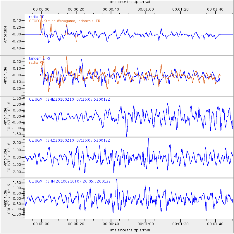
UGM GEOFON Station Wanagama, Indonesia - Earthquake Result Viewer
*The percent match for this event was below the threshold and hence no stack was calculated.
| Earthquake location: |
Solomon Islands |
| Earthquake latitude/longitude: |
-7.0/154.9 |
| Earthquake time(UTC): |
2010/02/10 (041) 07:18:29 GMT |
| Earthquake Depth: |
10 km |
| Earthquake Magnitude: |
5.6 MB, 5.2 MS, 5.5 MW, 5.5 MW |
| Earthquake Catalog/Contributor: |
WHDF/NEIC |
|
| Network: |
GE GEOFON |
| Station: |
UGM GEOFON Station Wanagama, Indonesia |
| Lat/Lon: |
7.91 S/110.52 E |
| Elevation: |
350 m |
|
| Distance: |
43.9 deg |
| Az: |
265.921 deg |
| Baz: |
91.953 deg |
| Ray Param: |
$rayparam |
*The percent match for this event was below the threshold and hence was not used in the summary stack. |
|
| Radial Match: |
62.987022 % |
| Radial Bump: |
400 |
| Transverse Match: |
61.37935 % |
| Transverse Bump: |
400 |
| SOD ConfigId: |
305946 |
| Insert Time: |
2010-05-04 06:36:17.275 +0000 |
| GWidth: |
2.5 |
| Max Bumps: |
400 |
| Tol: |
0.001 |
|
Signal To Noise
| Channel | StoN | STA | LTA |
| GE:UGM: :BHZ:20100210T07:26:05.520013Z | 2.8155608 | 6.522661E-7 | 2.3166473E-7 |
| GE:UGM: :BHN:20100210T07:26:05.520013Z | 0.82493246 | 2.0611247E-7 | 2.4985377E-7 |
| GE:UGM: :BHE:20100210T07:26:05.520013Z | 1.3584346 | 2.7741137E-7 | 2.0421403E-7 |
| Arrivals |
| Ps | |
| PpPs | |
| PsPs/PpSs | |


