
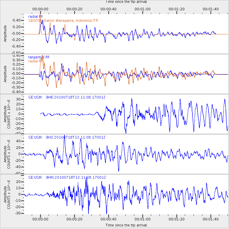
UGM GEOFON Station Wanagama, Indonesia - Earthquake Result Viewer
| ||||||||||||||||||
| ||||||||||||||||||
| ||||||||||||||||||
|
Signal To Noise
| Channel | StoN | STA | LTA |
| GE:UGM: :BHZ:20100718T13:11:08.17001Z | 3.2088847 | 6.012945E-6 | 1.8738426E-6 |
| GE:UGM: :BHN:20100718T13:11:08.17001Z | 1.2029595 | 1.311075E-6 | 1.0898746E-6 |
| GE:UGM: :BHE:20100718T13:11:08.17001Z | 1.6640385 | 2.3007337E-6 | 1.3826204E-6 |
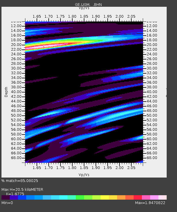
| Arrivals | |
| Ps | 2.4 SECOND |
| PpPs | 8.0 SECOND |
| PsPs/PpSs | 10 SECOND |

