You are here: Home > Network List > GE - GEOFON Stations List
> Station UGM GEOFON Station Wanagama, Indonesia > Earthquake Result Viewer
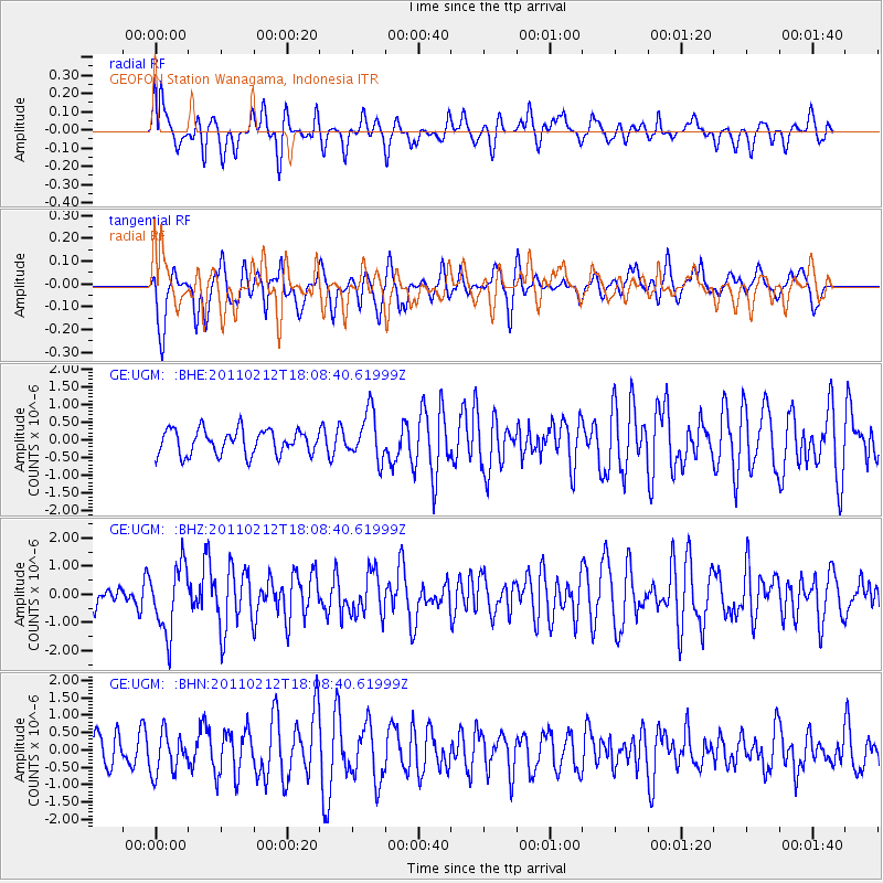
UGM GEOFON Station Wanagama, Indonesia - Earthquake Result Viewer
*The percent match for this event was below the threshold and hence no stack was calculated.
| Earthquake location: |
Tonga Islands |
| Earthquake latitude/longitude: |
-20.9/-175.7 |
| Earthquake time(UTC): |
2011/02/12 (043) 17:57:56 GMT |
| Earthquake Depth: |
90 km |
| Earthquake Magnitude: |
6.0 MB, 6.1 MW, 6.1 MW |
| Earthquake Catalog/Contributor: |
WHDF/NEIC |
|
| Network: |
GE GEOFON |
| Station: |
UGM GEOFON Station Wanagama, Indonesia |
| Lat/Lon: |
7.91 S/110.52 E |
| Elevation: |
350 m |
|
| Distance: |
72.1 deg |
| Az: |
268.197 deg |
| Baz: |
109.354 deg |
| Ray Param: |
$rayparam |
*The percent match for this event was below the threshold and hence was not used in the summary stack. |
|
| Radial Match: |
57.286373 % |
| Radial Bump: |
400 |
| Transverse Match: |
41.476288 % |
| Transverse Bump: |
379 |
| SOD ConfigId: |
350818 |
| Insert Time: |
2011-07-26 07:53:50.225 +0000 |
| GWidth: |
2.5 |
| Max Bumps: |
400 |
| Tol: |
0.001 |
|
Signal To Noise
| Channel | StoN | STA | LTA |
| GE:UGM: :BHZ:20110212T18:08:40.61999Z | 2.4454498 | 1.1816102E-6 | 4.8318725E-7 |
| GE:UGM: :BHN:20110212T18:08:40.61999Z | 1.1475264 | 5.7543406E-7 | 5.01456E-7 |
| GE:UGM: :BHE:20110212T18:08:40.61999Z | 1.9301994 | 6.693798E-7 | 3.467931E-7 |
| Arrivals |
| Ps | |
| PpPs | |
| PsPs/PpSs | |


