You are here: Home > Network List > GE - GEOFON Stations List
> Station UGM GEOFON Station Wanagama, Indonesia > Earthquake Result Viewer
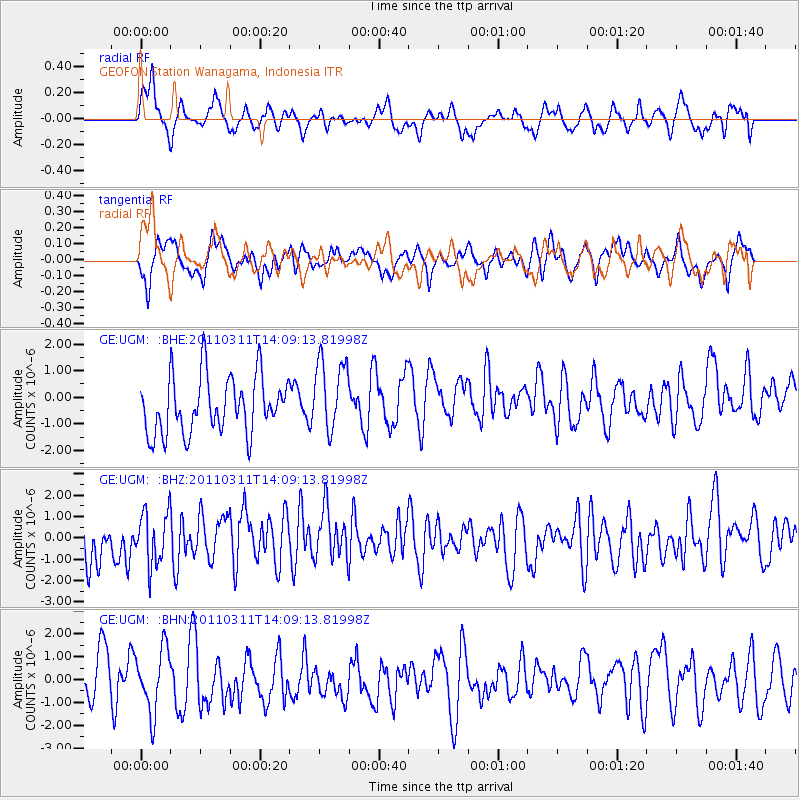
UGM GEOFON Station Wanagama, Indonesia - Earthquake Result Viewer
*The percent match for this event was below the threshold and hence no stack was calculated.
| Earthquake location: |
Near East Coast Of Honshu, Japan |
| Earthquake latitude/longitude: |
36.1/140.8 |
| Earthquake time(UTC): |
2011/03/11 (070) 14:00:38 GMT |
| Earthquake Depth: |
51 km |
| Earthquake Magnitude: |
5.5 MB, 5.4 MS |
| Earthquake Catalog/Contributor: |
WHDF/NEIC |
|
| Network: |
GE GEOFON |
| Station: |
UGM GEOFON Station Wanagama, Indonesia |
| Lat/Lon: |
7.91 S/110.52 E |
| Elevation: |
350 m |
|
| Distance: |
52.2 deg |
| Az: |
219.137 deg |
| Baz: |
31.056 deg |
| Ray Param: |
$rayparam |
*The percent match for this event was below the threshold and hence was not used in the summary stack. |
|
| Radial Match: |
50.36697 % |
| Radial Bump: |
400 |
| Transverse Match: |
55.669014 % |
| Transverse Bump: |
400 |
| SOD ConfigId: |
356183 |
| Insert Time: |
2011-08-16 19:09:10.206 +0000 |
| GWidth: |
2.5 |
| Max Bumps: |
400 |
| Tol: |
0.001 |
|
Signal To Noise
| Channel | StoN | STA | LTA |
| GE:UGM: :BHZ:20110311T14:09:13.81998Z | 0.9399227 | 1.2232915E-6 | 1.301481E-6 |
| GE:UGM: :BHN:20110311T14:09:13.81998Z | 1.3173832 | 1.3804882E-6 | 1.0479018E-6 |
| GE:UGM: :BHE:20110311T14:09:13.81998Z | 1.3008615 | 1.3937139E-6 | 1.0713776E-6 |
| Arrivals |
| Ps | |
| PpPs | |
| PsPs/PpSs | |


