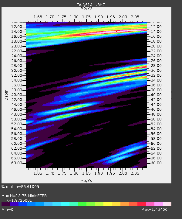
Q61A Milford, DE, USA - Earthquake Result Viewer
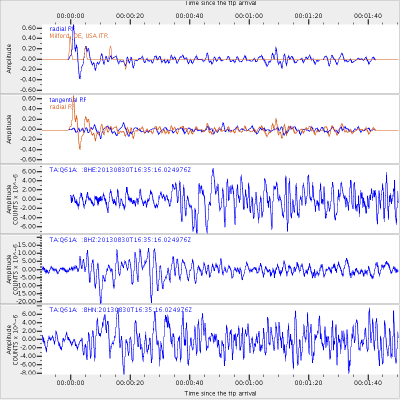
Earthquake location: Andreanof Islands, Aleutian Is.
Earthquake latitude/longitude: 51.5/-175.2
Earthquake time(UTC): 2013/08/30 (242) 16:25:02 GMT
Earthquake Depth: 29 km
Earthquake Magnitude: 7.0 MWW, 6.5 ML, 6.8 MI, 6.9 MWC, 6.9 MWB, 7.0 MWW, 7.0 MI, 7.0 MWC
Earthquake Catalog/Contributor: NEIC PDE/NEIC COMCAT
Network: TA USArray Transportable Network (new EarthScope stations)
Station: Q61A Milford, DE, USA
Lat/Lon: 38.88 N/75.33 W
Elevation: 5.0 m
Distance: 66.1 deg
Az: 57.212 deg
Baz: 317.723 deg
Ray Param: 0.057762917
Estimated Moho Depth: 13.75 km
Estimated Crust Vp/Vs: 1.97
Assumed Crust Vp: 6.287 km/s
Estimated Crust Vs: 3.188 km/s
Estimated Crust Poisson's Ratio: 0.33
Radial Match: 86.61005 %
Radial Bump: 400
Transverse Match: 66.38716 %
Transverse Bump: 400
SOD ConfigId: 626651
Insert Time: 2014-04-18 05:25:52.036 +0000
GWidth: 2.5
Max Bumps: 400
Tol: 0.001

Signal To Noise

ChannelStoNSTALTA
TA:Q61A: :BHZ:20130830T16:35:16.024976Z3.10476422.9663754E-69.554269E-7
TA:Q61A: :BHN:20130830T16:35:16.024976Z1.75972441.3268104E-67.539877E-7
TA:Q61A: :BHE:20130830T16:35:16.024976Z1.39765021.3701513E-69.803249E-7
Arrivals
Ps2.2 SECOND
PpPs6.3 SECOND
PsPs/PpSs8.5 SECOND