Q61A Milford, DE, USA - Earthquake Result Viewer
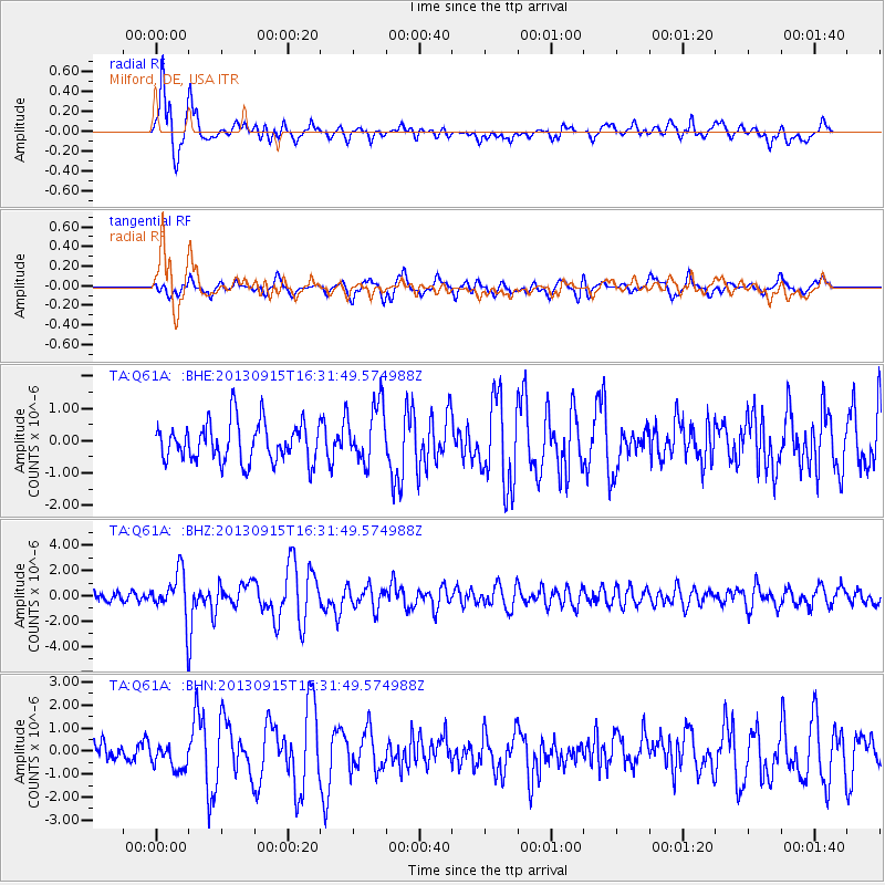
Earthquake location: Andreanof Islands, Aleutian Is.
Earthquake latitude/longitude: 51.6/-174.7
Earthquake time(UTC): 2013/09/15 (258) 16:21:37 GMT
Earthquake Depth: 24 km
Earthquake Magnitude: 6.1 MWW, 5.7 MI, 5.7 ML, 6.0 MWB, 6.1 MWC, 6.1 MWW
Earthquake Catalog/Contributor: NEIC PDE/NEIC COMCAT
Network: TA USArray Transportable Network (new EarthScope stations)
Station: Q61A Milford, DE, USA
Lat/Lon: 38.88 N/75.33 W
Elevation: 5.0 m
Distance: 65.9 deg
Az: 57.551 deg
Baz: 317.569 deg
Ray Param: 0.05796508
Estimated Moho Depth: 28.5 km
Estimated Crust Vp/Vs: 2.10
Assumed Crust Vp: 6.287 km/s
Estimated Crust Vs: 2.998 km/s
Estimated Crust Poisson's Ratio: 0.35
Radial Match: 84.47065 %
Radial Bump: 400
Transverse Match: 69.35876 %
Transverse Bump: 400
SOD ConfigId: 626651
Insert Time: 2014-04-18 17:32:14.704 +0000
GWidth: 2.5
Max Bumps: 400
Tol: 0.001

Signal To Noise

ChannelStoNSTALTA
TA:Q61A: :BHZ:20130915T16:31:49.574988Z5.63061.7414146E-63.092769E-7
TA:Q61A: :BHN:20130915T16:31:49.574988Z1.01557715.660297E-75.573479E-7
TA:Q61A: :BHE:20130915T16:31:49.574988Z1.51603279.201715E-76.069602E-7
Arrivals
Ps5.1 SECOND
PpPs14 SECOND
PsPs/PpSs19 SECOND