
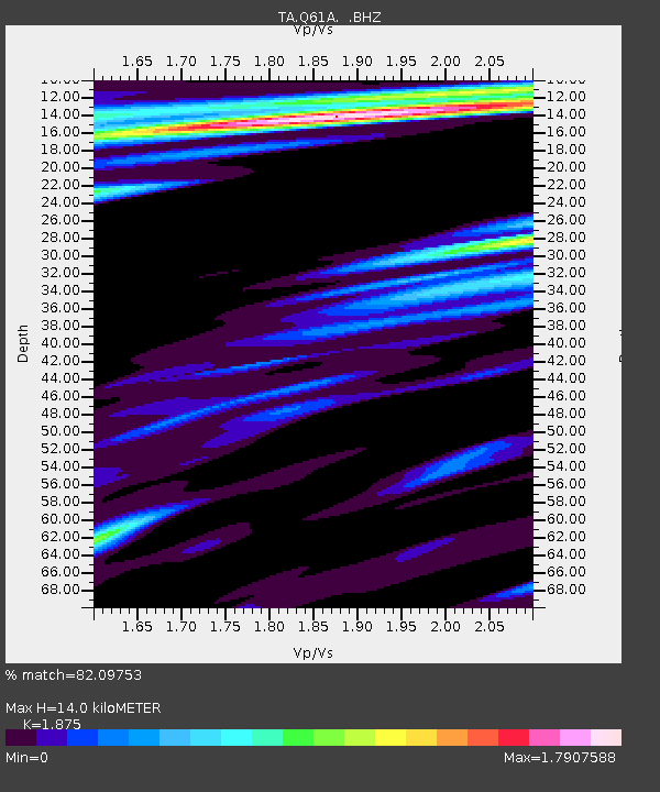
Q61A Milford, DE, USA - Earthquake Result Viewer
| ||||||||||||||||||
| ||||||||||||||||||
| ||||||||||||||||||
|
Signal To Noise
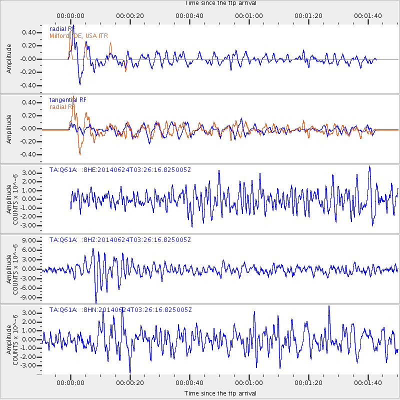
| Channel | StoN | STA | LTA |
| TA:Q61A: :BHZ:20140624T03:26:16.825005Z | 3.2465756 | 1.6278987E-6 | 5.0142023E-7 |
| TA:Q61A: :BHN:20140624T03:26:16.825005Z | 1.0111138 | 5.970292E-7 | 5.904669E-7 |
| TA:Q61A: :BHE:20140624T03:26:16.825005Z | 1.155485 | 6.912211E-7 | 5.982086E-7 |
| Arrivals | |
| Ps | 2.0 SECOND |
| PpPs | 6.2 SECOND |
| PsPs/PpSs | 8.2 SECOND |

