You are here: Home > Network List > TA - USArray Transportable Network (new EarthScope stations) Stations List
> Station Q61A Milford, DE, USA > Earthquake Result Viewer
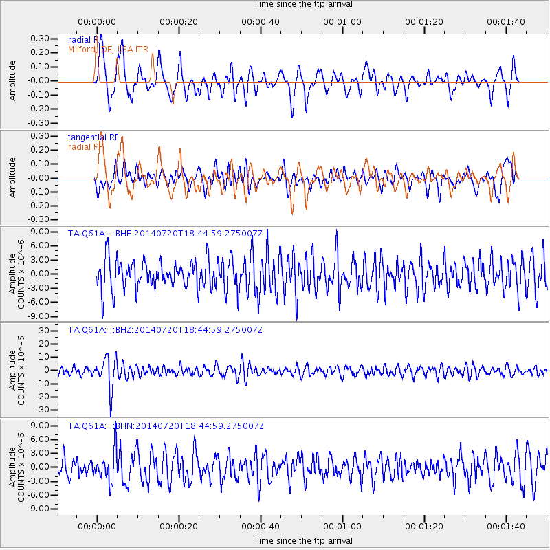
Q61A Milford, DE, USA - Earthquake Result Viewer
*The percent match for this event was below the threshold and hence no stack was calculated.
| Earthquake location: |
Kuril Islands |
| Earthquake latitude/longitude: |
44.6/148.7 |
| Earthquake time(UTC): |
2014/07/20 (201) 18:32:47 GMT |
| Earthquake Depth: |
61 km |
| Earthquake Magnitude: |
6.6 MB |
| Earthquake Catalog/Contributor: |
NEIC PDE/NEIC COMCAT |
|
| Network: |
TA USArray Transportable Network (new EarthScope stations) |
| Station: |
Q61A Milford, DE, USA |
| Lat/Lon: |
38.88 N/75.33 W |
| Elevation: |
5.0 m |
|
| Distance: |
87.9 deg |
| Az: |
32.894 deg |
| Baz: |
330.208 deg |
| Ray Param: |
$rayparam |
*The percent match for this event was below the threshold and hence was not used in the summary stack. |
|
| Radial Match: |
62.296803 % |
| Radial Bump: |
400 |
| Transverse Match: |
53.391716 % |
| Transverse Bump: |
400 |
| SOD ConfigId: |
751272 |
| Insert Time: |
2014-08-04 16:22:26.712 +0000 |
| GWidth: |
2.5 |
| Max Bumps: |
400 |
| Tol: |
0.001 |
|
Signal To Noise
| Channel | StoN | STA | LTA |
| TA:Q61A: :BHZ:20140720T18:44:59.275007Z | 4.5994825 | 1.1945462E-5 | 2.5971317E-6 |
| TA:Q61A: :BHN:20140720T18:44:59.275007Z | 1.6541835 | 3.4150248E-6 | 2.0644777E-6 |
| TA:Q61A: :BHE:20140720T18:44:59.275007Z | 1.1865295 | 3.3947736E-6 | 2.8610948E-6 |
| Arrivals |
| Ps | |
| PpPs | |
| PsPs/PpSs | |


