You are here: Home > Network List > TA - USArray Transportable Network (new EarthScope stations) Stations List
> Station Q61A Milford, DE, USA > Earthquake Result Viewer
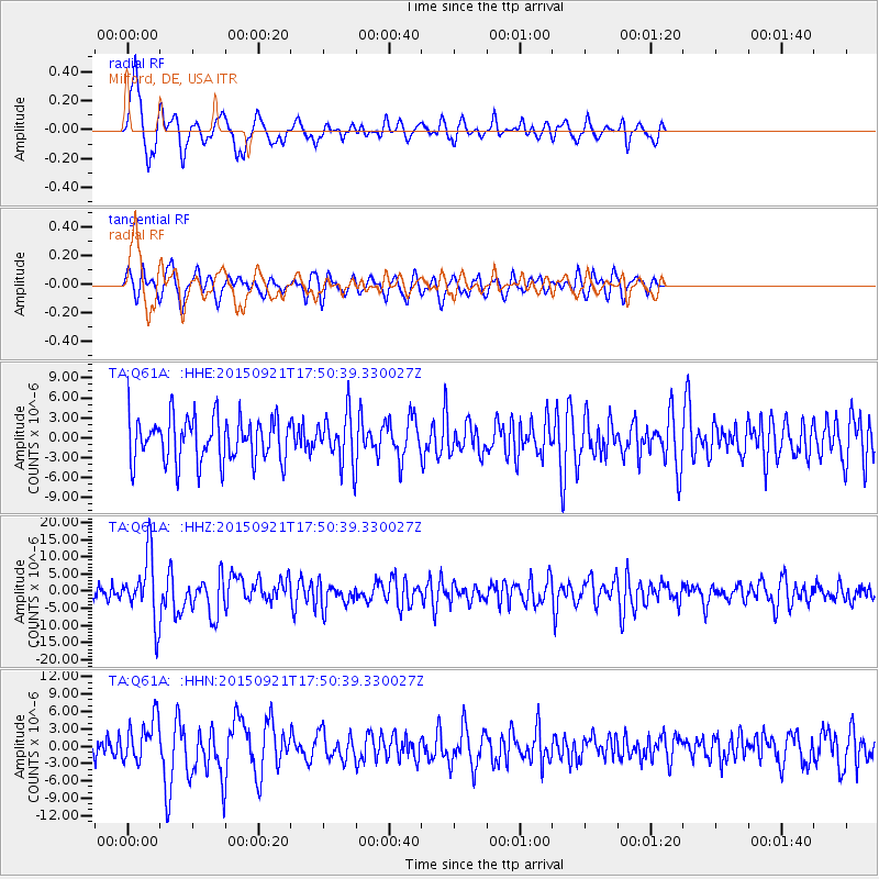
Q61A Milford, DE, USA - Earthquake Result Viewer
*The percent match for this event was below the threshold and hence no stack was calculated.
| Earthquake location: |
Near Coast Of Central Chile |
| Earthquake latitude/longitude: |
-31.7/-71.6 |
| Earthquake time(UTC): |
2015/09/21 (264) 17:39:58 GMT |
| Earthquake Depth: |
25 km |
| Earthquake Magnitude: |
6.5 MB, 6.5 MI, 6.6 MWW |
| Earthquake Catalog/Contributor: |
NEIC PDE/NEIC COMCAT |
|
| Network: |
TA USArray Transportable Network (new EarthScope stations) |
| Station: |
Q61A Milford, DE, USA |
| Lat/Lon: |
38.88 N/75.33 W |
| Elevation: |
5.0 m |
|
| Distance: |
70.3 deg |
| Az: |
356.942 deg |
| Baz: |
176.662 deg |
| Ray Param: |
$rayparam |
*The percent match for this event was below the threshold and hence was not used in the summary stack. |
|
| Radial Match: |
75.460686 % |
| Radial Bump: |
320 |
| Transverse Match: |
44.89498 % |
| Transverse Bump: |
400 |
| SOD ConfigId: |
7422571 |
| Insert Time: |
2019-04-20 23:35:31.770 +0000 |
| GWidth: |
2.5 |
| Max Bumps: |
400 |
| Tol: |
0.001 |
|
Signal To Noise
| Channel | StoN | STA | LTA |
| TA:Q61A: :HHZ:20150921T17:50:39.330027Z | 3.7282763 | 9.388314E-6 | 2.5181378E-6 |
| TA:Q61A: :HHN:20150921T17:50:39.330027Z | 1.5133073 | 3.7864154E-6 | 2.5020795E-6 |
| TA:Q61A: :HHE:20150921T17:50:39.330027Z | 1.1794009 | 3.8844855E-6 | 3.293609E-6 |
| Arrivals |
| Ps | |
| PpPs | |
| PsPs/PpSs | |


