You are here: Home > Network List > TA - USArray Transportable Network (new EarthScope stations) Stations List
> Station D22A Cohagen, MT, USA > Earthquake Result Viewer
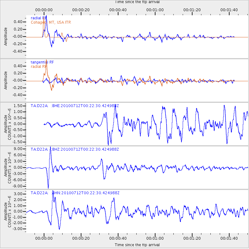
D22A Cohagen, MT, USA - Earthquake Result Viewer
*The percent match for this event was below the threshold and hence no stack was calculated.
| Earthquake location: |
Northern Chile |
| Earthquake latitude/longitude: |
-22.1/-68.2 |
| Earthquake time(UTC): |
2010/07/12 (193) 00:11:21 GMT |
| Earthquake Depth: |
115 km |
| Earthquake Magnitude: |
6.1 MB, 6.3 MW, 6.2 MW |
| Earthquake Catalog/Contributor: |
WHDF/NEIC |
|
| Network: |
TA USArray Transportable Network (new EarthScope stations) |
| Station: |
D22A Cohagen, MT, USA |
| Lat/Lon: |
47.15 N/106.18 W |
| Elevation: |
791 m |
|
| Distance: |
77.0 deg |
| Az: |
334.474 deg |
| Baz: |
144.174 deg |
| Ray Param: |
$rayparam |
*The percent match for this event was below the threshold and hence was not used in the summary stack. |
|
| Radial Match: |
96.54482 % |
| Radial Bump: |
292 |
| Transverse Match: |
87.86202 % |
| Transverse Bump: |
400 |
| SOD ConfigId: |
319893 |
| Insert Time: |
2011-01-05 02:14:23.152 +0000 |
| GWidth: |
2.5 |
| Max Bumps: |
400 |
| Tol: |
0.001 |
|
Signal To Noise
| Channel | StoN | STA | LTA |
| TA:D22A: :BHZ:20100712T00:22:30.424988Z | 31.061455 | 4.465849E-6 | 1.4377464E-7 |
| TA:D22A: :BHN:20100712T00:22:30.424988Z | 8.590434 | 1.2903159E-6 | 1.502038E-7 |
| TA:D22A: :BHE:20100712T00:22:30.424988Z | 6.040597 | 6.6338816E-7 | 1.0982163E-7 |
| Arrivals |
| Ps | |
| PpPs | |
| PsPs/PpSs | |


