You are here: Home > Network List > TA - USArray Transportable Network (new EarthScope stations) Stations List
> Station 243A Waterproof, LA, USA > Earthquake Result Viewer
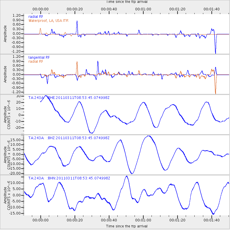
243A Waterproof, LA, USA - Earthquake Result Viewer
*The percent match for this event was below the threshold and hence no stack was calculated.
| Earthquake location: |
Eastern Honshu, Japan |
| Earthquake latitude/longitude: |
37.4/141.0 |
| Earthquake time(UTC): |
2011/03/11 (070) 08:40:56 GMT |
| Earthquake Depth: |
40 km |
| Earthquake Magnitude: |
5.9 MB |
| Earthquake Catalog/Contributor: |
WHDF/NEIC |
|
| Network: |
TA USArray Transportable Network (new EarthScope stations) |
| Station: |
243A Waterproof, LA, USA |
| Lat/Lon: |
31.88 N/91.48 W |
| Elevation: |
2.0 m |
|
| Distance: |
95.4 deg |
| Az: |
42.661 deg |
| Baz: |
320.657 deg |
| Ray Param: |
$rayparam |
*The percent match for this event was below the threshold and hence was not used in the summary stack. |
|
| Radial Match: |
59.70325 % |
| Radial Bump: |
392 |
| Transverse Match: |
75.78399 % |
| Transverse Bump: |
400 |
| SOD ConfigId: |
356183 |
| Insert Time: |
2011-08-13 22:20:05.249 +0000 |
| GWidth: |
2.5 |
| Max Bumps: |
400 |
| Tol: |
0.001 |
|
Signal To Noise
| Channel | StoN | STA | LTA |
| TA:243A: :BHZ:20110311T08:53:45.074998Z | 0.4404152 | 3.291756E-6 | 7.47421E-6 |
| TA:243A: :BHN:20110311T08:53:45.074998Z | 1.5410691 | 8.886979E-6 | 5.766762E-6 |
| TA:243A: :BHE:20110311T08:53:45.074998Z | 2.257517 | 3.0115634E-5 | 1.3340157E-5 |
| Arrivals |
| Ps | |
| PpPs | |
| PsPs/PpSs | |


