You are here: Home > Network List > TA - USArray Transportable Network (new EarthScope stations) Stations List
> Station 243A Waterproof, LA, USA > Earthquake Result Viewer
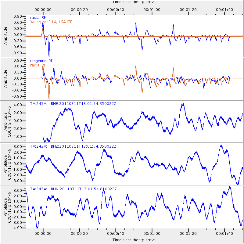
243A Waterproof, LA, USA - Earthquake Result Viewer
*The percent match for this event was below the threshold and hence no stack was calculated.
| Earthquake location: |
Near East Coast Of Honshu, Japan |
| Earthquake latitude/longitude: |
36.1/141.6 |
| Earthquake time(UTC): |
2011/03/11 (070) 12:49:02 GMT |
| Earthquake Depth: |
35 km |
| Earthquake Magnitude: |
5.6 MB |
| Earthquake Catalog/Contributor: |
WHDF/NEIC |
|
| Network: |
TA USArray Transportable Network (new EarthScope stations) |
| Station: |
243A Waterproof, LA, USA |
| Lat/Lon: |
31.88 N/91.48 W |
| Elevation: |
2.0 m |
|
| Distance: |
96.0 deg |
| Az: |
43.154 deg |
| Baz: |
319.404 deg |
| Ray Param: |
$rayparam |
*The percent match for this event was below the threshold and hence was not used in the summary stack. |
|
| Radial Match: |
61.241703 % |
| Radial Bump: |
400 |
| Transverse Match: |
46.325085 % |
| Transverse Bump: |
400 |
| SOD ConfigId: |
356183 |
| Insert Time: |
2011-08-16 06:57:18.547 +0000 |
| GWidth: |
2.5 |
| Max Bumps: |
400 |
| Tol: |
0.001 |
|
Signal To Noise
| Channel | StoN | STA | LTA |
| TA:243A: :BHZ:20110311T13:01:54.850022Z | 0.947756 | 1.0677403E-6 | 1.1265984E-6 |
| TA:243A: :BHN:20110311T13:01:54.850022Z | 0.81728417 | 1.9141721E-6 | 2.342113E-6 |
| TA:243A: :BHE:20110311T13:01:54.850022Z | 0.8441626 | 2.3067862E-6 | 2.7326325E-6 |
| Arrivals |
| Ps | |
| PpPs | |
| PsPs/PpSs | |


