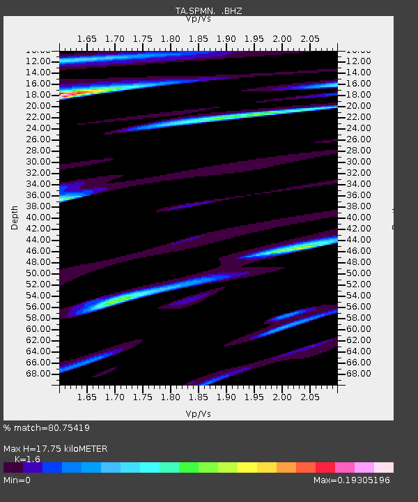
SPMN Marine on St. Croix, MN, USA - Earthquake Result Viewer

Earthquake location: Near East Coast Of Honshu, Japan
Earthquake latitude/longitude: 38.9/141.8
Earthquake time(UTC): 2012/06/17 (169) 20:32:20 GMT
Earthquake Depth: 36 km
Earthquake Magnitude: 6.0 MB, 5.9 MS, 6.3 MW, 6.4 MW
Earthquake Catalog/Contributor: WHDF/NEIC
Network: TA USArray Transportable Network (new EarthScope stations)
Station: SPMN Marine on St. Croix, MN, USA
Lat/Lon: 45.22 N/92.80 W
Elevation: 311 m
Distance: 82.9 deg
Az: 35.504 deg
Baz: 320.129 deg
Ray Param: 0.046515096
Estimated Moho Depth: 17.75 km
Estimated Crust Vp/Vs: 1.60
Assumed Crust Vp: 6.571 km/s
Estimated Crust Vs: 4.107 km/s
Estimated Crust Poisson's Ratio: 0.18
Radial Match: 80.75419 %
Radial Bump: 400
Transverse Match: 53.271587 %
Transverse Bump: 400
SOD ConfigId: 460165
Insert Time: 2013-02-11 21:09:07.410 +0000
GWidth: 2.5
Max Bumps: 400
Tol: 0.001

Signal To Noise

ChannelStoNSTALTA
TA:SPMN: :BHZ:20120617T20:44:10.449985Z11.7224046.813136E-75.8120644E-8
TA:SPMN: :BHN:20120617T20:44:10.449985Z1.77080932.3146592E-71.3071194E-7
TA:SPMN: :BHE:20120617T20:44:10.449985Z1.91586361.7317664E-79.0390905E-8
Arrivals
Ps1.7 SECOND
PpPs6.8 SECOND
PsPs/PpSs8.5 SECOND