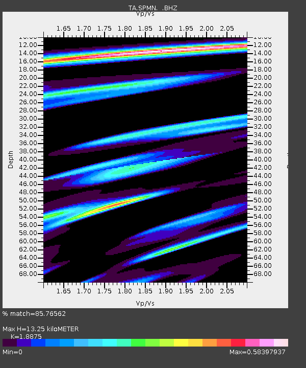
SPMN Marine on St. Croix, MN, USA - Earthquake Result Viewer

Earthquake location: Near Coast Of Northern Peru
Earthquake latitude/longitude: -5.4/-81.9
Earthquake time(UTC): 2013/08/12 (224) 09:49:32 GMT
Earthquake Depth: 10 km
Earthquake Magnitude: 6.2 MWW, 6.1 MWB, 6.2 MWW, 6.2 MWC, 6.3 MWC
Earthquake Catalog/Contributor: NEIC PDE/NEIC COMCAT
Network: TA USArray Transportable Network (new EarthScope stations)
Station: SPMN Marine on St. Croix, MN, USA
Lat/Lon: 45.22 N/92.80 W
Elevation: 311 m
Distance: 51.3 deg
Az: 350.165 deg
Baz: 166.075 deg
Ray Param: 0.06748433
Estimated Moho Depth: 13.25 km
Estimated Crust Vp/Vs: 1.89
Assumed Crust Vp: 6.571 km/s
Estimated Crust Vs: 3.481 km/s
Estimated Crust Poisson's Ratio: 0.30
Radial Match: 85.76562 %
Radial Bump: 339
Transverse Match: 65.64331 %
Transverse Bump: 400
SOD ConfigId: 626651
Insert Time: 2014-04-17 23:34:29.828 +0000
GWidth: 2.5
Max Bumps: 400
Tol: 0.001

Signal To Noise

ChannelStoNSTALTA
TA:SPMN: :BHZ:20130812T09:58:05.72499Z14.3976242.4185083E-61.6797969E-7
TA:SPMN: :BHN:20130812T09:58:05.72499Z4.38017031.3630753E-63.111923E-7
TA:SPMN: :BHE:20130812T09:58:05.72499Z2.84222053.116412E-71.0964708E-7
Arrivals
Ps1.9 SECOND
PpPs5.5 SECOND
PsPs/PpSs7.4 SECOND