You are here: Home > Network List > CI - Caltech Regional Seismic Network Stations List
> Station GSC Goldstone, Goldstone Lake, CA, USA > Earthquake Result Viewer
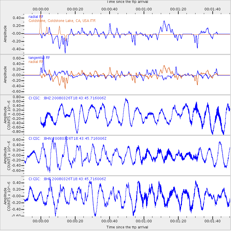
GSC Goldstone, Goldstone Lake, CA, USA - Earthquake Result Viewer
*The percent match for this event was below the threshold and hence no stack was calculated.
| Earthquake location: |
Kuril Islands |
| Earthquake latitude/longitude: |
46.4/153.0 |
| Earthquake time(UTC): |
2008/03/26 (086) 18:33:34 GMT |
| Earthquake Depth: |
17 km |
| Earthquake Magnitude: |
5.5 MB, 5.2 MS, 5.6 MW, 5.5 MW |
| Earthquake Catalog/Contributor: |
WHDF/NEIC |
|
| Network: |
CI Caltech Regional Seismic Network |
| Station: |
GSC Goldstone, Goldstone Lake, CA, USA |
| Lat/Lon: |
35.30 N/116.81 W |
| Elevation: |
1000 m |
|
| Distance: |
65.6 deg |
| Az: |
63.931 deg |
| Baz: |
310.569 deg |
| Ray Param: |
$rayparam |
*The percent match for this event was below the threshold and hence was not used in the summary stack. |
|
| Radial Match: |
40.8715 % |
| Radial Bump: |
400 |
| Transverse Match: |
50.52051 % |
| Transverse Bump: |
400 |
| SOD ConfigId: |
2504 |
| Insert Time: |
2010-02-25 23:48:59.464 +0000 |
| GWidth: |
2.5 |
| Max Bumps: |
400 |
| Tol: |
0.001 |
|
Signal To Noise
| Channel | StoN | STA | LTA |
| CI:GSC: :BHN:20080326T18:43:45.716006Z | 2.213647 | 3.2396773E-7 | 1.4635023E-7 |
| CI:GSC: :BHE:20080326T18:43:45.716006Z | 0.7518723 | 1.4785284E-7 | 1.9664621E-7 |
| CI:GSC: :BHZ:20080326T18:43:45.716006Z | 1.0989027 | 3.4593862E-7 | 3.1480369E-7 |
| Arrivals |
| Ps | |
| PpPs | |
| PsPs/PpSs | |


