HUMO Hull Mountain, OR - Earthquake Result Viewer
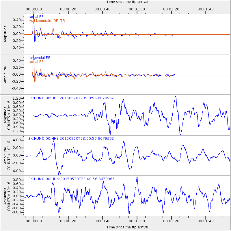
Earthquake location: Santa Cruz Islands Region
Earthquake latitude/longitude: -10.9/164.2
Earthquake time(UTC): 2015/05/20 (140) 22:48:53 GMT
Earthquake Depth: 12 km
Earthquake Magnitude: 6.8 MWW, 6.7 MWB, 6.8 MWC, 6.9 MI
Earthquake Catalog/Contributor: NEIC PDE/NEIC COMCAT
Network: BK Berkeley Digital Seismograph Network
Station: HUMO Hull Mountain, OR
Lat/Lon: 42.61 N/122.96 W
Elevation: 555 m
Distance: 85.0 deg
Az: 45.093 deg
Baz: 250.44 deg
Ray Param: 0.045061443
Estimated Moho Depth: 42.5 km
Estimated Crust Vp/Vs: 1.60
Assumed Crust Vp: 6.522 km/s
Estimated Crust Vs: 4.076 km/s
Estimated Crust Poisson's Ratio: 0.18
Radial Match: 94.220634 %
Radial Bump: 400
Transverse Match: 85.53187 %
Transverse Bump: 400
SOD ConfigId: 976571
Insert Time: 2015-06-03 22:56:10.239 +0000
GWidth: 2.5
Max Bumps: 400
Tol: 0.001

Signal To Noise

ChannelStoNSTALTA
BK:HUMO:00:HHZ:20150520T23:00:56.807996Z7.50474557.309668E-79.7400616E-8
BK:HUMO:00:HHN:20150520T23:00:56.807996Z2.18939859.919894E-84.5308763E-8
BK:HUMO:00:HHE:20150520T23:00:56.807996Z3.44904572.0479719E-75.937793E-8
Arrivals
Ps4.0 SECOND
PpPs16 SECOND
PsPs/PpSs20 SECOND