MAKZ Makanchi, Kazakhstan - Earthquake Result Viewer
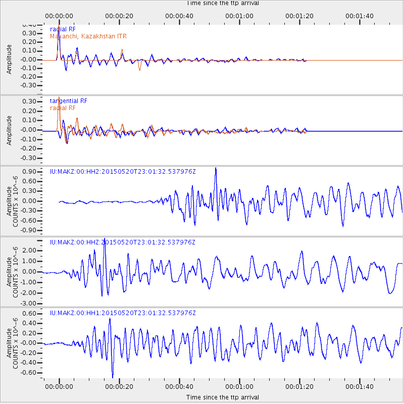
Earthquake location: Santa Cruz Islands Region
Earthquake latitude/longitude: -10.9/164.2
Earthquake time(UTC): 2015/05/20 (140) 22:48:53 GMT
Earthquake Depth: 12 km
Earthquake Magnitude: 6.8 MWW, 6.7 MWB, 6.8 MWC, 6.9 MI
Earthquake Catalog/Contributor: NEIC PDE/NEIC COMCAT
Network: IU Global Seismograph Network (GSN - IRIS/USGS)
Station: MAKZ Makanchi, Kazakhstan
Lat/Lon: 46.81 N/81.98 E
Elevation: 600 m
Distance: 92.6 deg
Az: 317.064 deg
Baz: 103.077 deg
Ray Param: 0.04143405
Estimated Moho Depth: 59.5 km
Estimated Crust Vp/Vs: 1.67
Assumed Crust Vp: 6.571 km/s
Estimated Crust Vs: 3.94 km/s
Estimated Crust Poisson's Ratio: 0.22
Radial Match: 96.22941 %
Radial Bump: 250
Transverse Match: 83.15746 %
Transverse Bump: 335
SOD ConfigId: 976571
Insert Time: 2015-06-03 22:57:38.113 +0000
GWidth: 2.5
Max Bumps: 400
Tol: 0.001

Signal To Noise

ChannelStoNSTALTA
IU:MAKZ:00:HHZ:20150520T23:01:32.537976Z4.1878381.6397927E-73.9156067E-8
IU:MAKZ:00:HH1:20150520T23:01:32.537976Z1.27235772.2929719E-81.802144E-8
IU:MAKZ:00:HH2:20150520T23:01:32.537976Z1.87554933.854235E-82.05499E-8
Arrivals
Ps6.2 SECOND
PpPs24 SECOND
PsPs/PpSs30 SECOND