You are here: Home > Network List > TA - USArray Transportable Network (new EarthScope stations) Stations List
> Station P60A Greenville, DE, USA > Earthquake Result Viewer
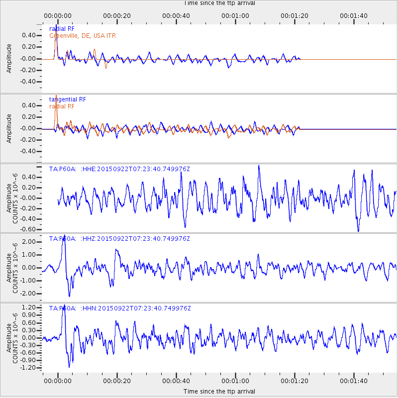
P60A Greenville, DE, USA - Earthquake Result Viewer
*The percent match for this event was below the threshold and hence no stack was calculated.
| Earthquake location: |
Near Coast Of Central Chile |
| Earthquake latitude/longitude: |
-31.5/-71.2 |
| Earthquake time(UTC): |
2015/09/22 (265) 07:12:59 GMT |
| Earthquake Depth: |
54 km |
| Earthquake Magnitude: |
6.1 MWB |
| Earthquake Catalog/Contributor: |
NEIC PDE/NEIC COMCAT |
|
| Network: |
TA USArray Transportable Network (new EarthScope stations) |
| Station: |
P60A Greenville, DE, USA |
| Lat/Lon: |
39.81 N/75.64 W |
| Elevation: |
105 m |
|
| Distance: |
71.0 deg |
| Az: |
356.385 deg |
| Baz: |
175.99 deg |
| Ray Param: |
$rayparam |
*The percent match for this event was below the threshold and hence was not used in the summary stack. |
|
| Radial Match: |
72.70996 % |
| Radial Bump: |
396 |
| Transverse Match: |
73.55154 % |
| Transverse Bump: |
400 |
| SOD ConfigId: |
7422571 |
| Insert Time: |
2019-04-21 00:04:10.516 +0000 |
| GWidth: |
2.5 |
| Max Bumps: |
400 |
| Tol: |
0.001 |
|
Signal To Noise
| Channel | StoN | STA | LTA |
| TA:P60A: :HHZ:20150922T07:23:40.749976Z | 7.8186994 | 1.2950824E-6 | 1.6563911E-7 |
| TA:P60A: :HHN:20150922T07:23:40.749976Z | 4.013282 | 6.748281E-7 | 1.6814869E-7 |
| TA:P60A: :HHE:20150922T07:23:40.749976Z | 1.1012969 | 1.3794758E-7 | 1.2525922E-7 |
| Arrivals |
| Ps | |
| PpPs | |
| PsPs/PpSs | |


