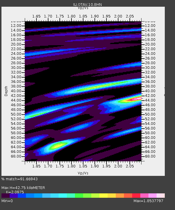
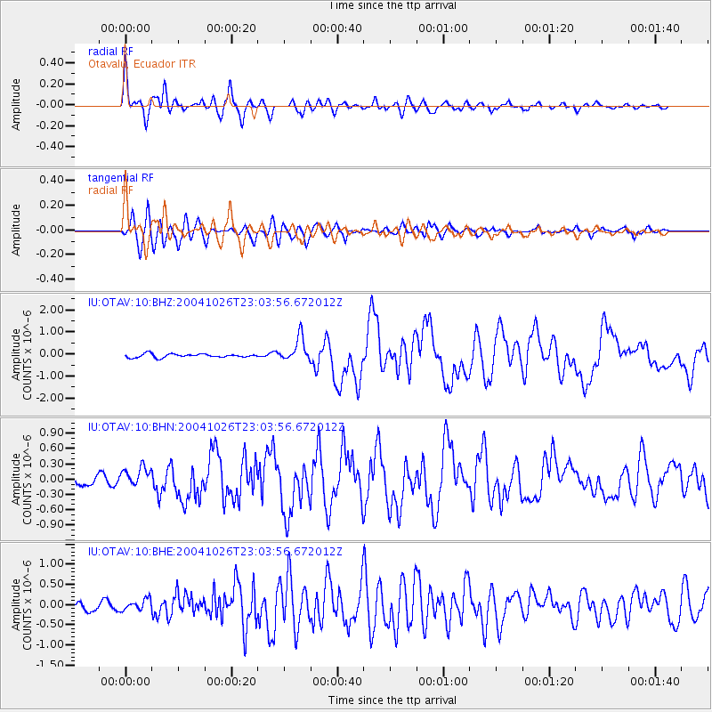
OTAV Otavalu, Ecuador - Earthquake Result Viewer

Earthquake location: South Sandwich Islands Region
Earthquake latitude/longitude: -57.1/-24.7
Earthquake time(UTC): 2004/10/26 (300) 22:53:07 GMT
Earthquake Depth: 10 km
Earthquake Magnitude: 5.6 MB, 6.3 MS, 6.4 MW, 6.2 MW
Earthquake Catalog/Contributor: WHDF/NEIC
Network: IU Global Seismograph Network (GSN - IRIS/USGS)
Station: OTAV Otavalu, Ecuador
Lat/Lon: 0.24 N/78.45 W
Elevation: 3507 m
Distance: 71.4 deg
Az: 301.654 deg
Baz: 152.295 deg
Ray Param: 0.054368943
Estimated Moho Depth: 42.75 km
Estimated Crust Vp/Vs: 2.10
Assumed Crust Vp: 6.472 km/s
Estimated Crust Vs: 3.086 km/s
Estimated Crust Poisson's Ratio: 0.35
Radial Match: 91.66943 %
Radial Bump: 400
Transverse Match: 86.57223 %
Transverse Bump: 400
SOD ConfigId: 2459
Insert Time: 2010-03-04 20:34:08.039 +0000
GWidth: 2.5
Max Bumps: 400
Tol: 0.001

Signal To Noise

ChannelStoNSTALTA
IU:OTAV:10:BHN:20041026T23:03:56.672012Z2.7654311.8811016E-76.802201E-8
IU:OTAV:10:BHE:20041026T23:03:56.672012Z1.4245431.3681486E-79.604123E-8
IU:OTAV:10:BHZ:20041026T23:03:56.672012Z6.8651635.528607E-78.053133E-8
Arrivals
Ps7.5 SECOND
PpPs20 SECOND
PsPs/PpSs27 SECOND