PTCN Pitcairn Island, South Pacific - Earthquake Result Viewer
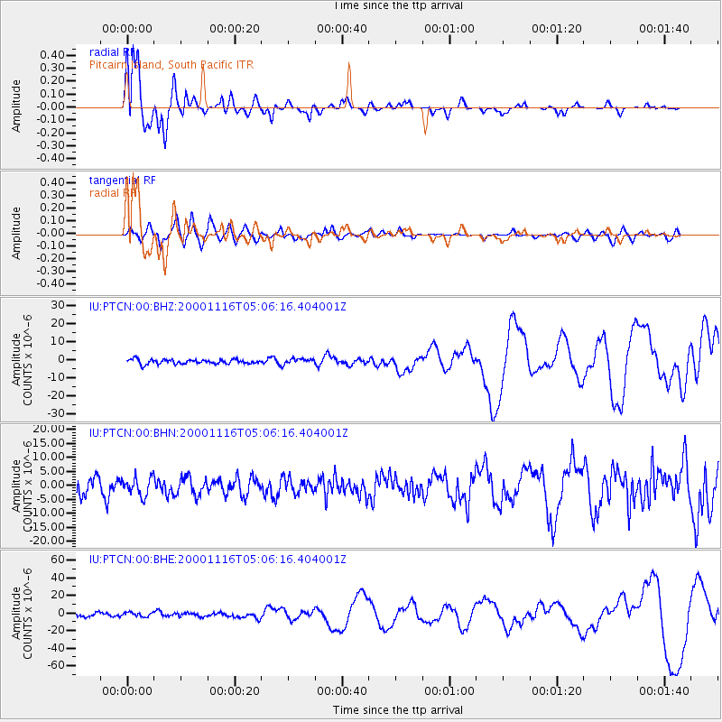
Earthquake location: New Ireland Region, P.N.G.
Earthquake latitude/longitude: -4.0/152.2
Earthquake time(UTC): 2000/11/16 (321) 04:54:56 GMT
Earthquake Depth: 33 km
Earthquake Magnitude: 6.0 MB, 8.2 MS, 8.0 MW, 8.0 ME
Earthquake Catalog/Contributor: WHDF/NEIC
Network: IU Global Seismograph Network (GSN - IRIS/USGS)
Station: PTCN Pitcairn Island, South Pacific
Lat/Lon: 25.07 S/130.10 W
Elevation: 220 m
Distance: 77.2 deg
Az: 114.675 deg
Baz: 271.574 deg
Ray Param: 0.050424933
Estimated Moho Depth: 33.0 km
Estimated Crust Vp/Vs: 2.10
Assumed Crust Vp: 4.24 km/s
Estimated Crust Vs: 2.021 km/s
Estimated Crust Poisson's Ratio: 0.35
Radial Match: 96.761795 %
Radial Bump: 324
Transverse Match: 52.442284 %
Transverse Bump: 400
SOD ConfigId: 3744
Insert Time: 2010-03-04 20:34:27.510 +0000
GWidth: 2.5
Max Bumps: 400
Tol: 0.001

Signal To Noise

ChannelStoNSTALTA
IU:PTCN:00:BHN:20001116T05:06:16.404001Z1.13359083.3042052E-62.914813E-6
IU:PTCN:00:BHE:20001116T05:06:16.404001Z1.10160982.393621E-62.1728392E-6
IU:PTCN:00:BHZ:20001116T05:06:16.404001Z1.25596361.5234276E-61.2129552E-6
Arrivals
Ps8.6 SECOND
PpPs24 SECOND
PsPs/PpSs32 SECOND