You are here: Home > Network List > TA - USArray Transportable Network (new EarthScope stations) Stations List
> Station O48A Farmland, IN, USA > Earthquake Result Viewer
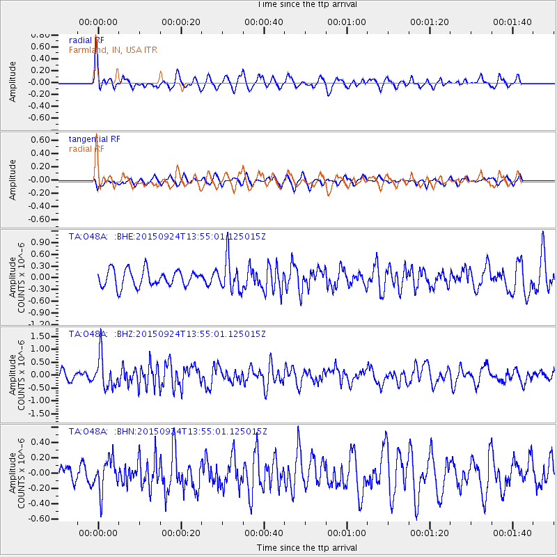
O48A Farmland, IN, USA - Earthquake Result Viewer
*The percent match for this event was below the threshold and hence no stack was calculated.
| Earthquake location: |
Vancouver Island, Canada Region |
| Earthquake latitude/longitude: |
50.7/-130.2 |
| Earthquake time(UTC): |
2015/09/24 (267) 13:48:58 GMT |
| Earthquake Depth: |
10 km |
| Earthquake Magnitude: |
5.5 MB, 5.6 MI |
| Earthquake Catalog/Contributor: |
NEIC PDE/NEIC COMCAT |
|
| Network: |
TA USArray Transportable Network (new EarthScope stations) |
| Station: |
O48A Farmland, IN, USA |
| Lat/Lon: |
40.26 N/85.16 W |
| Elevation: |
300 m |
|
| Distance: |
32.8 deg |
| Az: |
90.866 deg |
| Baz: |
303.872 deg |
| Ray Param: |
$rayparam |
*The percent match for this event was below the threshold and hence was not used in the summary stack. |
|
| Radial Match: |
56.061317 % |
| Radial Bump: |
400 |
| Transverse Match: |
58.87603 % |
| Transverse Bump: |
400 |
| SOD ConfigId: |
7422571 |
| Insert Time: |
2019-04-21 00:19:43.863 +0000 |
| GWidth: |
2.5 |
| Max Bumps: |
400 |
| Tol: |
0.001 |
|
Signal To Noise
| Channel | StoN | STA | LTA |
| TA:O48A: :BHZ:20150924T13:55:01.125015Z | 3.8682146 | 6.39074E-7 | 1.6521162E-7 |
| TA:O48A: :BHN:20150924T13:55:01.125015Z | 1.1942682 | 2.1306917E-7 | 1.7840982E-7 |
| TA:O48A: :BHE:20150924T13:55:01.125015Z | 2.0051944 | 4.2424227E-7 | 2.1157163E-7 |
| Arrivals |
| Ps | |
| PpPs | |
| PsPs/PpSs | |


