You are here: Home > Network List > IW - Intermountain West Stations List
> Station MOOW Moose Ponds, Wyoming, USA > Earthquake Result Viewer
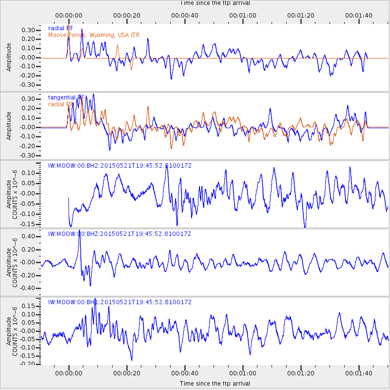
MOOW Moose Ponds, Wyoming, USA - Earthquake Result Viewer
*The percent match for this event was below the threshold and hence no stack was calculated.
| Earthquake location: |
Solomon Islands |
| Earthquake latitude/longitude: |
-9.8/160.3 |
| Earthquake time(UTC): |
2015/05/21 (141) 19:32:57 GMT |
| Earthquake Depth: |
10 km |
| Earthquake Magnitude: |
6.0 MWB |
| Earthquake Catalog/Contributor: |
NEIC PDE/NEIC COMCAT |
|
| Network: |
IW Intermountain West |
| Station: |
MOOW Moose Ponds, Wyoming, USA |
| Lat/Lon: |
43.75 N/110.74 W |
| Elevation: |
2128 m |
|
| Distance: |
95.9 deg |
| Az: |
46.755 deg |
| Baz: |
262.2 deg |
| Ray Param: |
$rayparam |
*The percent match for this event was below the threshold and hence was not used in the summary stack. |
|
| Radial Match: |
57.371098 % |
| Radial Bump: |
400 |
| Transverse Match: |
57.688396 % |
| Transverse Bump: |
400 |
| SOD ConfigId: |
976571 |
| Insert Time: |
2015-06-04 19:49:14.844 +0000 |
| GWidth: |
2.5 |
| Max Bumps: |
400 |
| Tol: |
0.001 |
|
Signal To Noise
| Channel | StoN | STA | LTA |
| IW:MOOW:00:BHZ:20150521T19:45:52.810017Z | 3.480804 | 1.6711535E-7 | 4.801056E-8 |
| IW:MOOW:00:BH1:20150521T19:45:52.810017Z | 0.69726354 | 4.1814072E-8 | 5.9968826E-8 |
| IW:MOOW:00:BH2:20150521T19:45:52.810017Z | 1.074174 | 6.5298345E-8 | 6.0789354E-8 |
| Arrivals |
| Ps | |
| PpPs | |
| PsPs/PpSs | |


