You are here: Home > Network List > IW - Intermountain West Stations List
> Station PLID Pearl Lake, Idaho, USA > Earthquake Result Viewer
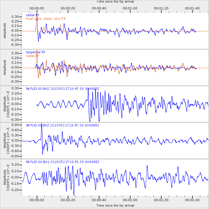
PLID Pearl Lake, Idaho, USA - Earthquake Result Viewer
*The percent match for this event was below the threshold and hence no stack was calculated.
| Earthquake location: |
Solomon Islands |
| Earthquake latitude/longitude: |
-9.8/160.3 |
| Earthquake time(UTC): |
2015/05/21 (141) 19:32:57 GMT |
| Earthquake Depth: |
10 km |
| Earthquake Magnitude: |
6.0 MWB |
| Earthquake Catalog/Contributor: |
NEIC PDE/NEIC COMCAT |
|
| Network: |
IW Intermountain West |
| Station: |
PLID Pearl Lake, Idaho, USA |
| Lat/Lon: |
45.09 N/116.00 W |
| Elevation: |
2164 m |
|
| Distance: |
92.4 deg |
| Az: |
44.806 deg |
| Baz: |
258.675 deg |
| Ray Param: |
$rayparam |
*The percent match for this event was below the threshold and hence was not used in the summary stack. |
|
| Radial Match: |
72.024284 % |
| Radial Bump: |
400 |
| Transverse Match: |
65.925476 % |
| Transverse Bump: |
400 |
| SOD ConfigId: |
976571 |
| Insert Time: |
2015-06-04 19:49:15.158 +0000 |
| GWidth: |
2.5 |
| Max Bumps: |
400 |
| Tol: |
0.001 |
|
Signal To Noise
| Channel | StoN | STA | LTA |
| IW:PLID:00:BHZ:20150521T19:45:36.904988Z | 6.593334 | 3.5366162E-7 | 5.363927E-8 |
| IW:PLID:00:BH1:20150521T19:45:36.904988Z | 1.2918615 | 3.908565E-8 | 3.0255293E-8 |
| IW:PLID:00:BH2:20150521T19:45:36.904988Z | 3.6322155 | 1.4687778E-7 | 4.0437516E-8 |
| Arrivals |
| Ps | |
| PpPs | |
| PsPs/PpSs | |


