You are here: Home > Network List > US - United States National Seismic Network Stations List
> Station HAWA Hanford, Washington, USA > Earthquake Result Viewer
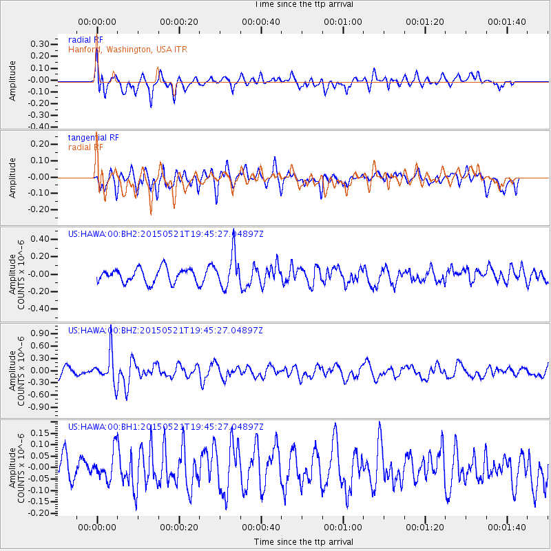
HAWA Hanford, Washington, USA - Earthquake Result Viewer
*The percent match for this event was below the threshold and hence no stack was calculated.
| Earthquake location: |
Solomon Islands |
| Earthquake latitude/longitude: |
-9.8/160.3 |
| Earthquake time(UTC): |
2015/05/21 (141) 19:32:57 GMT |
| Earthquake Depth: |
10 km |
| Earthquake Magnitude: |
6.0 MWB |
| Earthquake Catalog/Contributor: |
NEIC PDE/NEIC COMCAT |
|
| Network: |
US United States National Seismic Network |
| Station: |
HAWA Hanford, Washington, USA |
| Lat/Lon: |
46.39 N/119.53 W |
| Elevation: |
364 m |
|
| Distance: |
90.3 deg |
| Az: |
42.994 deg |
| Baz: |
256.195 deg |
| Ray Param: |
$rayparam |
*The percent match for this event was below the threshold and hence was not used in the summary stack. |
|
| Radial Match: |
62.774727 % |
| Radial Bump: |
400 |
| Transverse Match: |
60.68457 % |
| Transverse Bump: |
400 |
| SOD ConfigId: |
976571 |
| Insert Time: |
2015-06-04 19:49:47.973 +0000 |
| GWidth: |
2.5 |
| Max Bumps: |
400 |
| Tol: |
0.001 |
|
Signal To Noise
| Channel | StoN | STA | LTA |
| US:HAWA:00:BHZ:20150521T19:45:27.04897Z | 3.3785522 | 3.822462E-7 | 1.1313905E-7 |
| US:HAWA:00:BH1:20150521T19:45:27.04897Z | 1.3244637 | 6.391887E-8 | 4.826019E-8 |
| US:HAWA:00:BH2:20150521T19:45:27.04897Z | 2.3988492 | 1.9358824E-7 | 8.070046E-8 |
| Arrivals |
| Ps | |
| PpPs | |
| PsPs/PpSs | |


