You are here: Home > Network List > US - United States National Seismic Network Stations List
> Station MSO Missoula, Montana, USA > Earthquake Result Viewer
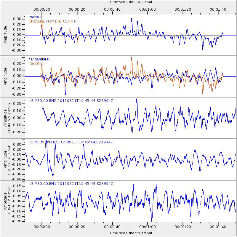
MSO Missoula, Montana, USA - Earthquake Result Viewer
*The percent match for this event was below the threshold and hence no stack was calculated.
| Earthquake location: |
Solomon Islands |
| Earthquake latitude/longitude: |
-9.8/160.3 |
| Earthquake time(UTC): |
2015/05/21 (141) 19:32:57 GMT |
| Earthquake Depth: |
10 km |
| Earthquake Magnitude: |
6.0 MWB |
| Earthquake Catalog/Contributor: |
NEIC PDE/NEIC COMCAT |
|
| Network: |
US United States National Seismic Network |
| Station: |
MSO Missoula, Montana, USA |
| Lat/Lon: |
46.83 N/113.94 W |
| Elevation: |
1264 m |
|
| Distance: |
94.1 deg |
| Az: |
43.354 deg |
| Baz: |
260.234 deg |
| Ray Param: |
$rayparam |
*The percent match for this event was below the threshold and hence was not used in the summary stack. |
|
| Radial Match: |
55.475067 % |
| Radial Bump: |
400 |
| Transverse Match: |
56.820866 % |
| Transverse Bump: |
400 |
| SOD ConfigId: |
976571 |
| Insert Time: |
2015-06-04 19:49:54.638 +0000 |
| GWidth: |
2.5 |
| Max Bumps: |
400 |
| Tol: |
0.001 |
|
Signal To Noise
| Channel | StoN | STA | LTA |
| US:MSO:00:BHZ:20150521T19:45:44.823994Z | 2.5292344 | 1.7345293E-7 | 6.8579226E-8 |
| US:MSO:00:BH1:20150521T19:45:44.823994Z | 0.89908344 | 5.0741644E-8 | 5.6437084E-8 |
| US:MSO:00:BH2:20150521T19:45:44.823994Z | 1.2665417 | 8.0697724E-8 | 6.371502E-8 |
| Arrivals |
| Ps | |
| PpPs | |
| PsPs/PpSs | |


