You are here: Home > Network List > TA - USArray Transportable Network (new EarthScope stations) Stations List
> Station J25K Salcha River, AK, USA > Earthquake Result Viewer
J25K Salcha River, AK, USA - Earthquake Result Viewer

| Earthquake location: |
Solomon Islands |
| Earthquake latitude/longitude: |
-10.1/160.5 |
| Earthquake time(UTC): |
2015/09/24 (267) 15:56:57 GMT |
| Earthquake Depth: |
23 km |
| Earthquake Magnitude: |
6.0 MB |
| Earthquake Catalog/Contributor: |
NEIC PDE/NEIC COMCAT |
|
| Network: |
TA USArray Transportable Network (new EarthScope stations) |
| Station: |
J25K Salcha River, AK, USA |
| Lat/Lon: |
64.61 N/145.37 W |
| Elevation: |
949 m |
|
| Distance: |
84.8 deg |
| Az: |
20.537 deg |
| Baz: |
233.247 deg |
| Ray Param: |
0.04520013 |
| Estimated Moho Depth: |
41.0 km |
| Estimated Crust Vp/Vs: |
1.63 |
| Assumed Crust Vp: |
6.566 km/s |
| Estimated Crust Vs: |
4.016 km/s |
| Estimated Crust Poisson's Ratio: |
0.20 |
|
| Radial Match: |
85.0239 % |
| Radial Bump: |
400 |
| Transverse Match: |
78.560684 % |
| Transverse Bump: |
400 |
| SOD ConfigId: |
7422571 |
| Insert Time: |
2019-04-21 00:31:50.194 +0000 |
| GWidth: |
2.5 |
| Max Bumps: |
400 |
| Tol: |
0.001 |
|
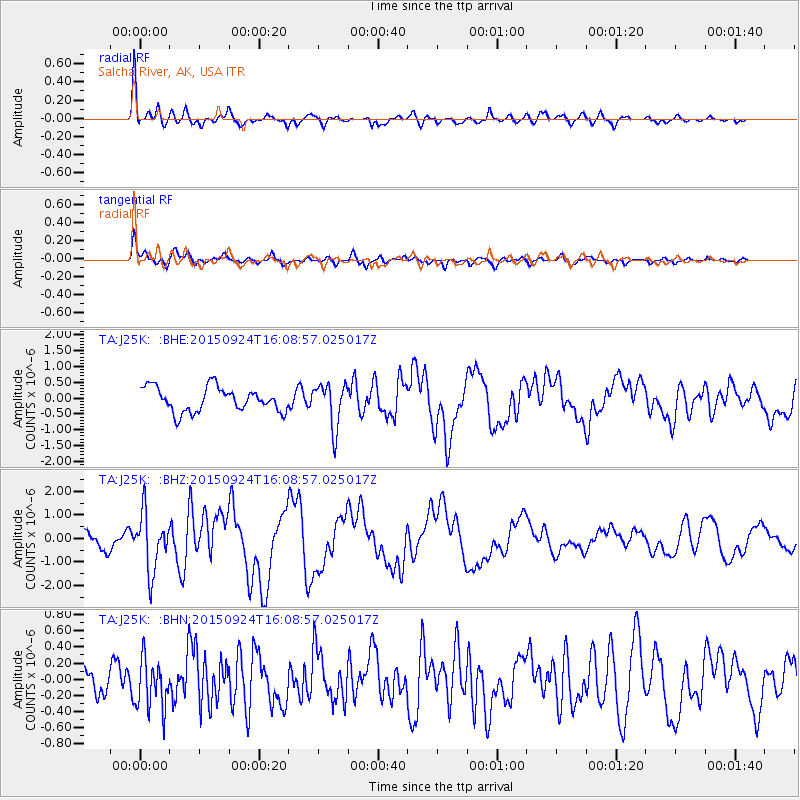
Signal To Noise
| Channel | StoN | STA | LTA |
| TA:J25K: :BHZ:20150924T16:08:57.025017Z | 2.33631 | 1.2155217E-6 | 5.2027417E-7 |
| TA:J25K: :BHN:20150924T16:08:57.025017Z | 1.5137956 | 3.044717E-7 | 2.0113133E-7 |
| TA:J25K: :BHE:20150924T16:08:57.025017Z | 1.9180217 | 7.19589E-7 | 3.7517253E-7 |
| Arrivals |
| Ps | 4.1 SECOND |
| PpPs | 16 SECOND |
| PsPs/PpSs | 20 SECOND |


