You are here: Home > Network List > TA - USArray Transportable Network (new EarthScope stations) Stations List
> Station TPFO Pinon Flats, CA, USA > Earthquake Result Viewer
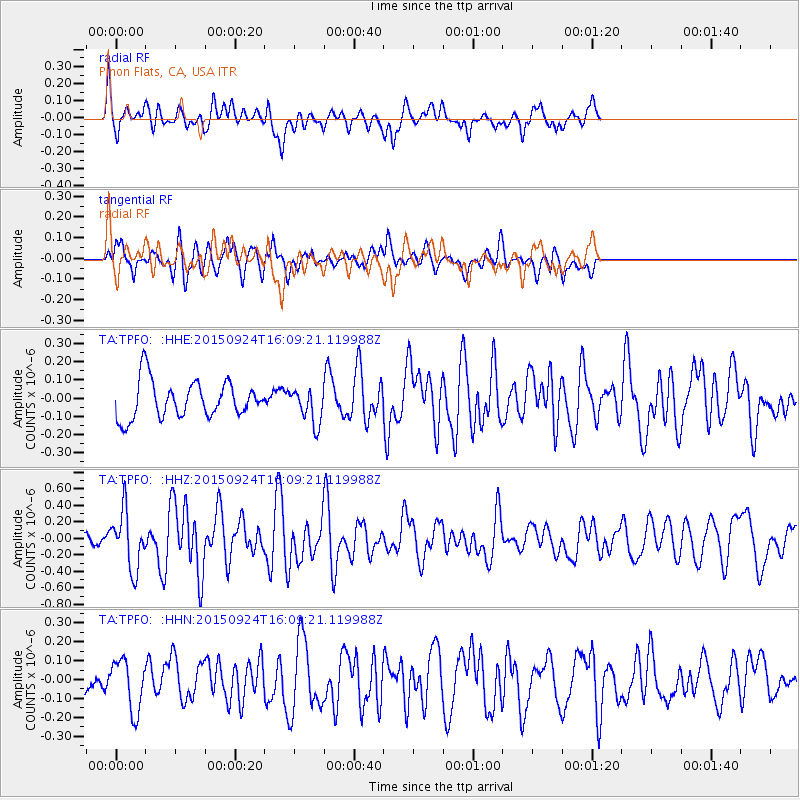
TPFO Pinon Flats, CA, USA - Earthquake Result Viewer
*The percent match for this event was below the threshold and hence no stack was calculated.
| Earthquake location: |
Solomon Islands |
| Earthquake latitude/longitude: |
-10.1/160.5 |
| Earthquake time(UTC): |
2015/09/24 (267) 15:56:57 GMT |
| Earthquake Depth: |
23 km |
| Earthquake Magnitude: |
6.0 MB |
| Earthquake Catalog/Contributor: |
NEIC PDE/NEIC COMCAT |
|
| Network: |
TA USArray Transportable Network (new EarthScope stations) |
| Station: |
TPFO Pinon Flats, CA, USA |
| Lat/Lon: |
33.61 N/116.45 W |
| Elevation: |
1275 m |
|
| Distance: |
89.8 deg |
| Az: |
55.94 deg |
| Baz: |
257.778 deg |
| Ray Param: |
$rayparam |
*The percent match for this event was below the threshold and hence was not used in the summary stack. |
|
| Radial Match: |
74.28793 % |
| Radial Bump: |
399 |
| Transverse Match: |
57.322937 % |
| Transverse Bump: |
400 |
| SOD ConfigId: |
7422571 |
| Insert Time: |
2019-04-21 00:32:06.926 +0000 |
| GWidth: |
2.5 |
| Max Bumps: |
400 |
| Tol: |
0.001 |
|
Signal To Noise
| Channel | StoN | STA | LTA |
| TA:TPFO: :HHZ:20150924T16:09:21.119988Z | 2.4704757 | 3.4530672E-7 | 1.3977338E-7 |
| TA:TPFO: :HHN:20150924T16:09:21.119988Z | 2.073267 | 1.3564227E-7 | 6.542441E-8 |
| TA:TPFO: :HHE:20150924T16:09:21.119988Z | 1.3250449 | 1.2863777E-7 | 9.7081816E-8 |
| Arrivals |
| Ps | |
| PpPs | |
| PsPs/PpSs | |


