You are here: Home > Network List > UW - Pacific Northwest Regional Seismic Network Stations List
> Station LEBA Lebam, WA, USA > Earthquake Result Viewer
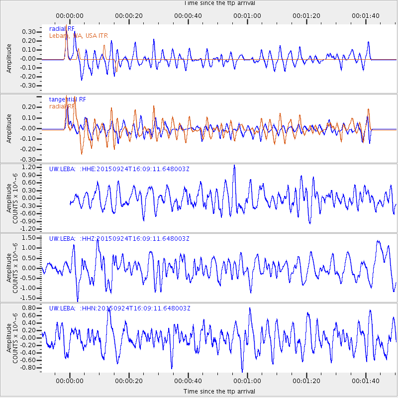
LEBA Lebam, WA, USA - Earthquake Result Viewer
*The percent match for this event was below the threshold and hence no stack was calculated.
| Earthquake location: |
Solomon Islands |
| Earthquake latitude/longitude: |
-10.1/160.5 |
| Earthquake time(UTC): |
2015/09/24 (267) 15:56:57 GMT |
| Earthquake Depth: |
23 km |
| Earthquake Magnitude: |
6.0 MB |
| Earthquake Catalog/Contributor: |
NEIC PDE/NEIC COMCAT |
|
| Network: |
UW Pacific Northwest Regional Seismic Network |
| Station: |
LEBA Lebam, WA, USA |
| Lat/Lon: |
46.55 N/123.56 W |
| Elevation: |
73 m |
|
| Distance: |
87.8 deg |
| Az: |
42.07 deg |
| Baz: |
252.899 deg |
| Ray Param: |
$rayparam |
*The percent match for this event was below the threshold and hence was not used in the summary stack. |
|
| Radial Match: |
66.30182 % |
| Radial Bump: |
400 |
| Transverse Match: |
63.064533 % |
| Transverse Bump: |
400 |
| SOD ConfigId: |
7422571 |
| Insert Time: |
2019-04-21 00:32:52.551 +0000 |
| GWidth: |
2.5 |
| Max Bumps: |
400 |
| Tol: |
0.001 |
|
Signal To Noise
| Channel | StoN | STA | LTA |
| UW:LEBA: :HHZ:20150924T16:09:11.648003Z | 2.1792843 | 6.887071E-7 | 3.1602443E-7 |
| UW:LEBA: :HHN:20150924T16:09:11.648003Z | 1.2687593 | 2.3202982E-7 | 1.8287932E-7 |
| UW:LEBA: :HHE:20150924T16:09:11.648003Z | 0.83100665 | 2.6674317E-7 | 3.20988E-7 |
| Arrivals |
| Ps | |
| PpPs | |
| PsPs/PpSs | |


