QSPA South Pole Remote Earth Science Observatory (Quiet Zone) - Earthquake Result Viewer
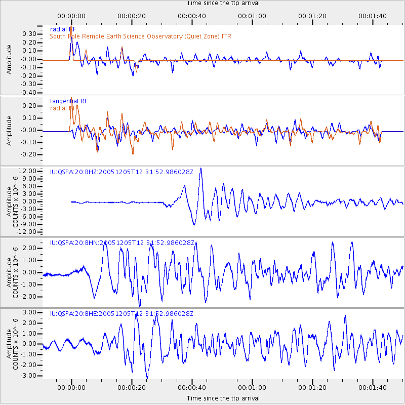
Earthquake location: Lake Tanganyika Region
Earthquake latitude/longitude: -6.2/29.8
Earthquake time(UTC): 2005/12/05 (339) 12:19:56 GMT
Earthquake Depth: 22 km
Earthquake Magnitude: 6.4 MB, 7.2 MS, 6.8 MW, 6.7 MW
Earthquake Catalog/Contributor: WHDF/NEIC
Network: IU Global Seismograph Network (GSN - IRIS/USGS)
Station: QSPA South Pole Remote Earth Science Observatory (Quiet Zone)
Lat/Lon: 89.93 S/145.00 E
Elevation: 2860 m
Distance: 83.8 deg
Az: 179.934 deg
Baz: 244.823 deg
Ray Param: 0.045874134
Estimated Moho Depth: 15.0 km
Estimated Crust Vp/Vs: 1.83
Assumed Crust Vp: 6.193 km/s
Estimated Crust Vs: 3.389 km/s
Estimated Crust Poisson's Ratio: 0.29
Radial Match: 91.9287 %
Radial Bump: 400
Transverse Match: 90.2285 %
Transverse Bump: 400
SOD ConfigId: 2422
Insert Time: 2010-03-04 20:40:48.880 +0000
GWidth: 2.5
Max Bumps: 400
Tol: 0.001

Signal To Noise

ChannelStoNSTALTA
IU:QSPA:20:BHN:20051205T12:31:52.986028Z0.93029572.0108826E-72.1615519E-7
IU:QSPA:20:BHE:20051205T12:31:52.986028Z1.61812943.046443E-71.8826944E-7
IU:QSPA:20:BHZ:20051205T12:31:52.986028Z5.99435959.290246E-71.5498314E-7
Arrivals
Ps2.1 SECOND
PpPs6.7 SECOND
PsPs/PpSs8.7 SECOND