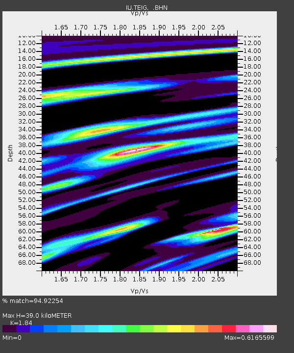
TEIG Tepich, Yucatan, Mexico - Earthquake Result Viewer

Earthquake location: Andreanof Islands, Aleutian Is.
Earthquake latitude/longitude: 51.6/-177.7
Earthquake time(UTC): 1999/03/20 (079) 10:47:45 GMT
Earthquake Depth: 33 km
Earthquake Magnitude: 6.3 MB, 6.8 MS, 6.9 MW, 6.8 ME
Earthquake Catalog/Contributor: WHDF/NEIC
Network: IU Global Seismograph Network (GSN - IRIS/USGS)
Station: TEIG Tepich, Yucatan, Mexico
Lat/Lon: 20.23 N/88.28 W
Elevation: 69 m
Distance: 74.0 deg
Az: 77.59 deg
Baz: 319.546 deg
Ray Param: 0.052547056
Estimated Moho Depth: 39.0 km
Estimated Crust Vp/Vs: 1.84
Assumed Crust Vp: 5.817 km/s
Estimated Crust Vs: 3.162 km/s
Estimated Crust Poisson's Ratio: 0.29
Radial Match: 94.92254 %
Radial Bump: 400
Transverse Match: 85.49592 %
Transverse Bump: 400
SOD ConfigId: 4480
Insert Time: 2010-03-04 20:42:03.426 +0000
GWidth: 2.5
Max Bumps: 400
Tol: 0.001

Signal To Noise

ChannelStoNSTALTA
IU:TEIG: :BHN:19990320T10:58:47.526008Z28.6893734.163516E-61.4512399E-7
IU:TEIG: :BHE:19990320T10:58:47.526008Z1.22228671.6398639E-71.341636E-7
IU:TEIG: :BHZ:19990320T10:58:47.526008Z6.2272291.8337342E-62.9447034E-7
Arrivals
Ps5.8 SECOND
PpPs19 SECOND
PsPs/PpSs24 SECOND