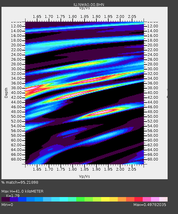
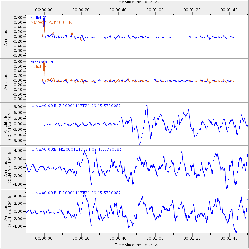
NWAO Narrogin, Australia - Earthquake Result Viewer

Earthquake location: New Britain Region, P.N.G.
Earthquake latitude/longitude: -5.5/151.8
Earthquake time(UTC): 2000/11/17 (322) 21:01:56 GMT
Earthquake Depth: 33 km
Earthquake Magnitude: 6.2 MB, 8.0 MS, 7.6 MW, 6.9 ME
Earthquake Catalog/Contributor: WHDF/NEIC
Network: IU Global Seismograph Network (GSN - IRIS/USGS)
Station: NWAO Narrogin, Australia
Lat/Lon: 32.93 S/117.23 E
Elevation: 265 m
Distance: 42.2 deg
Az: 225.26 deg
Baz: 57.218 deg
Ray Param: 0.07326211
Estimated Moho Depth: 41.0 km
Estimated Crust Vp/Vs: 1.79
Assumed Crust Vp: 6.419 km/s
Estimated Crust Vs: 3.586 km/s
Estimated Crust Poisson's Ratio: 0.27
Radial Match: 95.21898 %
Radial Bump: 261
Transverse Match: 66.07354 %
Transverse Bump: 400
SOD ConfigId: 3744
Insert Time: 2010-03-04 20:42:38.014 +0000
GWidth: 2.5
Max Bumps: 400
Tol: 0.001

Signal To Noise

ChannelStoNSTALTA
IU:NWAO:00:BHN:20001117T21:09:15.573008Z0.64670273.0032555E-74.6439507E-7
IU:NWAO:00:BHE:20001117T21:09:15.573008Z1.19185523.478554E-72.918605E-7
IU:NWAO:00:BHZ:20001117T21:09:15.573008Z0.89027034.803088E-75.39509E-7
Arrivals
Ps5.4 SECOND
PpPs17 SECOND
PsPs/PpSs22 SECOND