
NWAO Narrogin, Australia - Earthquake Result Viewer
| ||||||||||||||||||
| ||||||||||||||||||
| ||||||||||||||||||
|
Signal To Noise
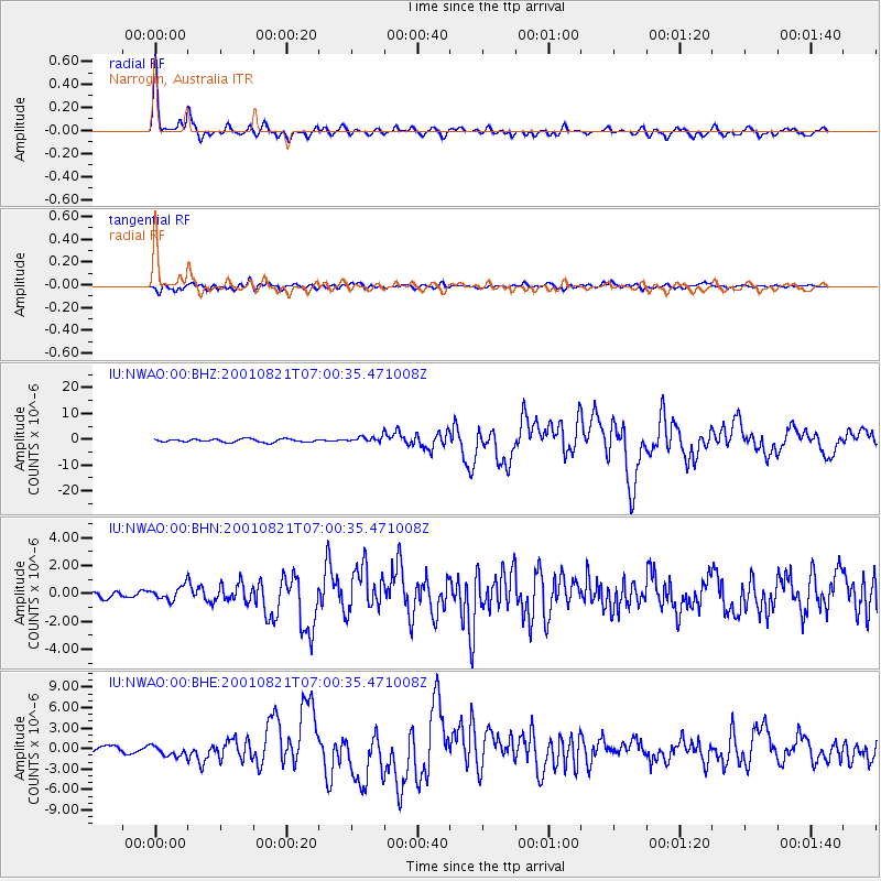
| Channel | StoN | STA | LTA |
| IU:NWAO:00:BHN:20010821T07:00:35.471008Z | 1.2181363 | 4.903953E-7 | 4.0257834E-7 |
| IU:NWAO:00:BHE:20010821T07:00:35.471008Z | 2.0075965 | 8.375441E-7 | 4.1718747E-7 |
| IU:NWAO:00:BHZ:20010821T07:00:35.471008Z | 1.8219657 | 1.1057757E-6 | 6.069136E-7 |
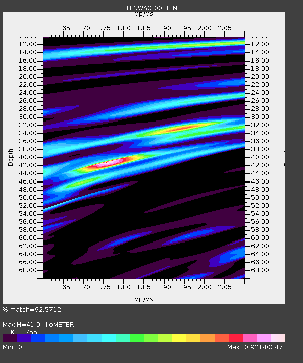
| Arrivals | |
| Ps | 5.1 SECOND |
| PpPs | 17 SECOND |
| PsPs/PpSs | 22 SECOND |

