NWAO Narrogin, Australia - Earthquake Result Viewer
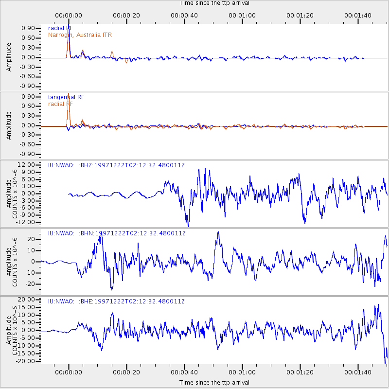
Earthquake location: Eastern New Guinea Reg., P.N.G.
Earthquake latitude/longitude: -5.5/147.9
Earthquake time(UTC): 1997/12/22 (356) 02:05:50 GMT
Earthquake Depth: 179 km
Earthquake Magnitude: 6.3 MB, 6.7 MS, 7.1 UNKNOWN, 7.0 ME
Earthquake Catalog/Contributor: WHDF/NEIC
Network: IU Global Seismograph Network (GSN - IRIS/USGS)
Station: NWAO Narrogin, Australia
Lat/Lon: 32.93 S/117.23 E
Elevation: 265 m
Distance: 39.5 deg
Az: 222.376 deg
Baz: 52.917 deg
Ray Param: 0.074297726
Estimated Moho Depth: 26.75 km
Estimated Crust Vp/Vs: 2.09
Assumed Crust Vp: 6.419 km/s
Estimated Crust Vs: 3.075 km/s
Estimated Crust Poisson's Ratio: 0.35
Radial Match: 95.32084 %
Radial Bump: 252
Transverse Match: 77.03018 %
Transverse Bump: 400
SOD ConfigId: 4480
Insert Time: 2010-03-04 20:43:53.733 +0000
GWidth: 2.5
Max Bumps: 400
Tol: 0.001

Signal To Noise

ChannelStoNSTALTA
IU:NWAO: :BHN:19971222T02:12:32.480011Z8.0833045.715192E-67.0703663E-7
IU:NWAO: :BHE:19971222T02:12:32.480011Z8.8905082.6646176E-62.997149E-7
IU:NWAO: :BHZ:19971222T02:12:32.480011Z4.1099422.837158E-66.903158E-7
Arrivals
Ps4.8 SECOND
PpPs12 SECOND
PsPs/PpSs17 SECOND